
Azavea’s Summer of Maps is a spatial analysis services grant and fellowship program that employs and trains promising GIS analysts to perform high impact geospatial analysis for nonprofits. Nonprofits apply with data analysis project ideas and are matched with top students. Applications for the program open for nonprofits in December and Fellows in February of each year, with selections made by mid-April.
Azavea has trained eleven Fellows and performed twenty-two non-profit projects since 2012. Past projects have focused on public schools, sustainability, traffic safety, urban planning, and social services. One notable nonprofit success story was from the Delaware Valley Association for the Education of Young Children (DVAEYC) in 2013. Azavea Fellow Lena Ferguson analyzed Philadelphia’s disparities in high quality early childhood education. DVAEYC presented the results and won a half million dollars in funding from the Philadelphia City Council, which the William Penn Foundation matched.
In 2015, Summer of Maps Fellows Kevin Frech, Laura Laderman, and Nathaniel Henry focused on social services and the environment. Azavea GIS analysts mentor the Fellows throughout the 12-week summer program. Fellows learn advanced GIS analysis, project management, and client interaction through hands-on involvement with every step of the project. Fellow Laura Laderman said: “The best days are always the ones when I have a meeting with one of the organizations I’m working with… I have really enjoyed the ability to go through this iterative process with the organizations, from learning about their work and the questions they are trying to answer, to producing some maps and analysis and talking about what they see in them and what would make them even more useful.” Fellows also take part in workshops given by Azavea analysts, designers, and software engineers.
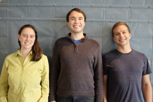
Temple University student, Kevin Frech (right), mapped the effects of urban development in Maine’s Penobscot Bay. He also explored the effects of beautification of vacant land parcels in Philadelphia. Swarthmore College student, Laura Laderman (left), focused on community health organizations. She analyzed health care needs for African immigrants in Philadelphia and mapped service areas for English Speakers of Other Languages students in Sunset Park, Brooklyn. Nathaniel Henry (center) of Ohio State University created a tree planting prioritization model for Detroit. Nathanial also examined the legal needs of the disabled across Philadelphia.
Many Summer of Maps Fellows advance in geography-related careers. Employers of alumni include: Arizona State University, MIT, Initiative for a Competitive Inner City, Hubspot, The City of Philadelphia, The Library of Congress, and even Azavea! If you’re interested in learning more about Summer of Maps, its projects, alumni, or how to apply, visit www.summerofmaps.com.
We can’t do it alone. If you are a business or foundation interested in sponsoring Summer of Maps, please be in touch.