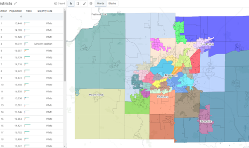
DistrictBuilder Provides a Fair & Public-Driven Map Drawing Process in Dane County DistrictBuilder puts the power of drawing electoral maps in the hands of the people of Dane County, Wisconsin.
Raster Vision Our open source Raster Vision project makes it easy for teams to build computer vision models to understand and analyze geospatial...
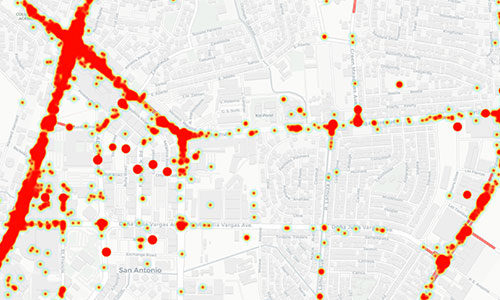
Addressing the Global Epidemic of Road Crashes An open source platform created in partnership with the World Bank to mitigate road accidents through road incident data management and analysis.
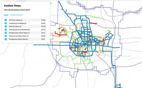
Open Transit Indicators An open-source tool to support transport agencies in planning and managing public transit systems.