If you had the opportunity to design a new subway line for your city, where would you put it? Where should the stations be?
We worked with The World Bank to build Open Transit Indicators, an open source tool that helps transit planners answer these types of questions. Open Transit Indicators enables users to assess the quality of existing transit systems, design scenarios for expanding or changing their cities’ transit systems, and compare measurements of service quality between different cities.
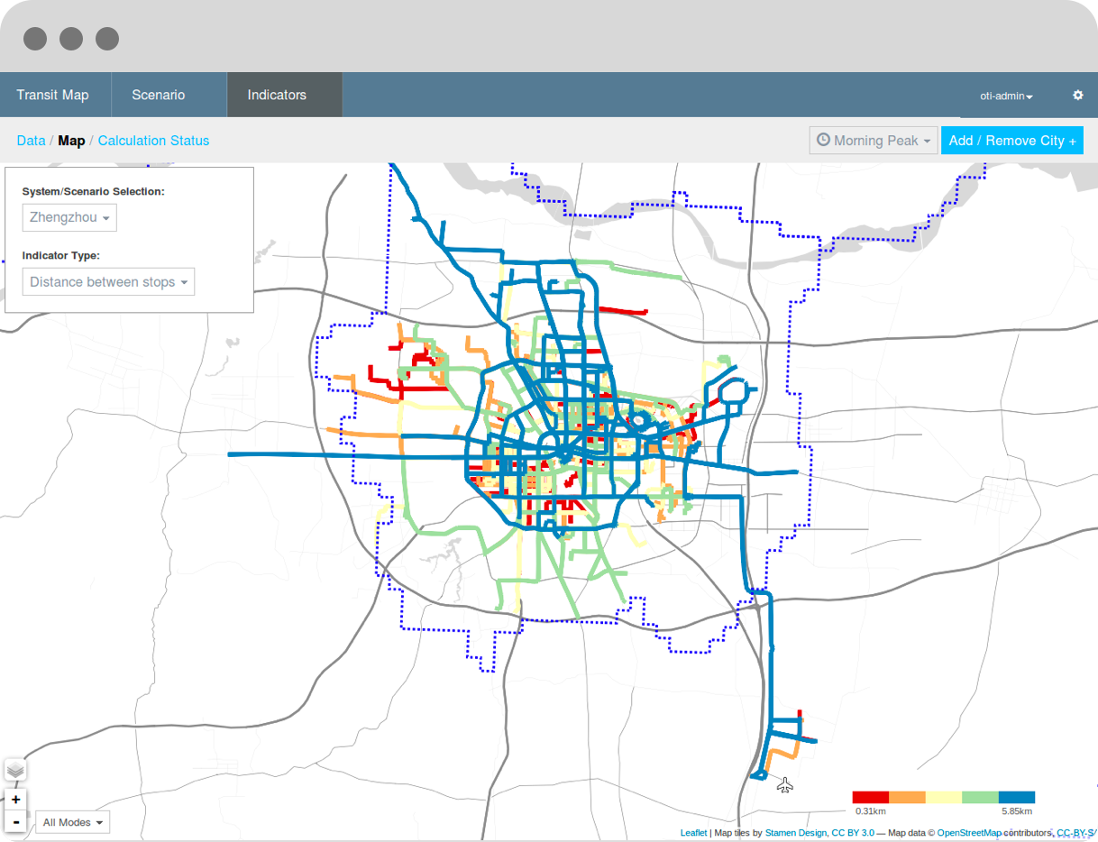
The Open Transit Indicators project was developed by The World Bank, in partnership with the Chinese Academy of Transport Science and the Haiphong Department of Transportation (Vietnam). The application uses information about a city’s transit system, along with additional data about demographics, to calculate baseline indicators of transit service quality, such as average distance between transit stops and average service frequency. The service quality indicators can then be used to compare one city’s transit system to those of other cities, identify possibilities for service improvement, and evaluate the effect of hypothetical service changes. For instance, users could, if they wanted to, compare Zhengzhou, China (about 4 million people) to Philadelphia and Chicago.
Open Transit Indicators imports information about transit systems using the GTFS format (General Transit Feed Specification); many cities already make information about their transit systems available in GTFS format, so they can be analyzed and compared using the Open Transit Indicators. As its name implies, Open Transit Indicators is open source and freely available, so anyone can use it to design the perfect transit system for their city. The source code can be downloaded from GitHub at https://github.com/WorldBank-Transport/open-transit-indicators