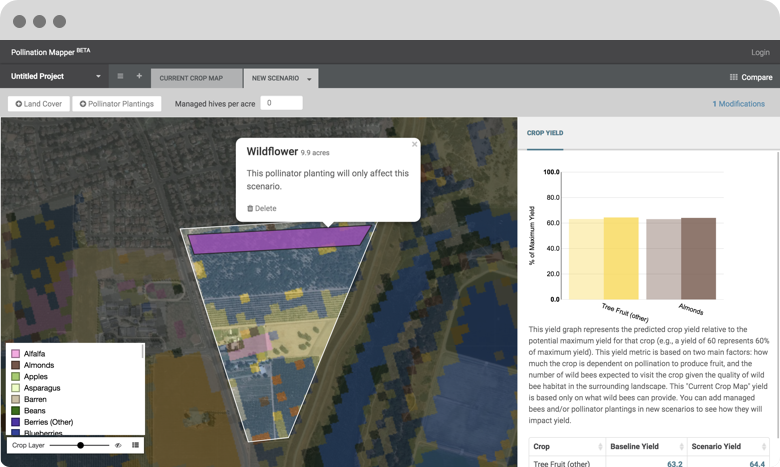
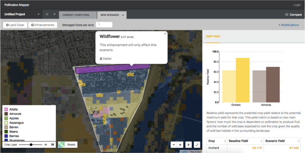
Pollination Mapper enables farmers and advisors to assess the costs and benefits of bee pollination enhancements on farm operations.
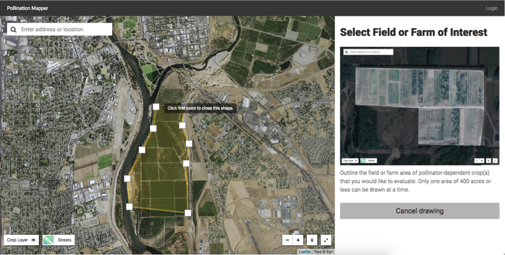
This intuitive tool applies scientific models to the real landscape, enabling farmers to draw a field or other area of interest on satellite imagery. Then, the app evaluates the quality of wild bee habitat near the area of interest based on several data sets. The tool uses that information to develop an index of visitation to the target crop field.
The Integrated Crop Pollination Project (ICP Bees) is a five-year effort funded by USDA-NIFA to investigate the performance, economics, and farmer perceptions of different pollination strategies in various fruit and vegetable crops. These include complete reliance on honey bees, farm habitat manipulation to enhance suitability for bees, and use of managed native bees alone or in combination with honey bees.
This project is a great example of the advantages of open source. We were able to leverage the source code from the Stroud Water Research Center’s Model My Watershed project to build Pollination Mapper. We removed the stormwater modeling components from Model My Watershed and replace them with new features that fit the Pollination Mapper use-case.
We’re in the planning stages of a next phase that will enable beekeepers to place their apiaries on the map. With access to hive-specific data, farmers will be able to use the tool to model forage distance calculations. Pennsylvania State University and the USDA are supporting this new work.