Preserving our vital water resources for future generations
There is a growing consensus that the supply of clean, fresh water will be severely impacted in the coming decades by factors ranging from climate change to overdevelopment to stormwater runoff in local watersheds. Citizen engagement is becoming a key factor in monitoring, managing, protecting, and restoring the local waterways within each watershed that are the primary sources of fresh water for many communities.
In an effort to advance the knowledge and stewardship of clean, healthy watersheds, Azavea worked with the Stroud Water Research Center and a range of other stakeholders to develop an easy-to-use, professional-grade watershed modeling package that runs in a web browser. The result is Model My Watershed®, a suite of tools that is informing land-use decisions, supporting conservation practices, and enhancing watershed education throughout the United States.
Landscape alterations dramatically impact stormwater runoff
Developed with funding from the National Science Foundation and William Penn Foundation, Model My Watershed enables its users to learn more about the impact of potential land use changes in their neighborhoods and watersheds.
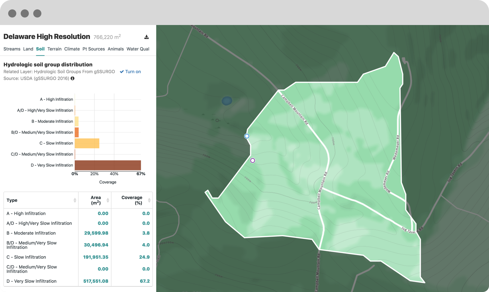
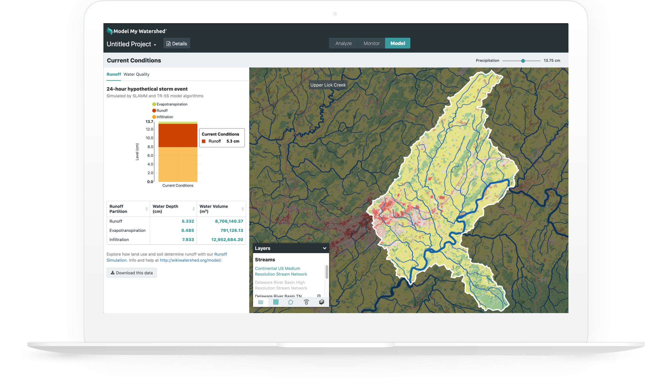
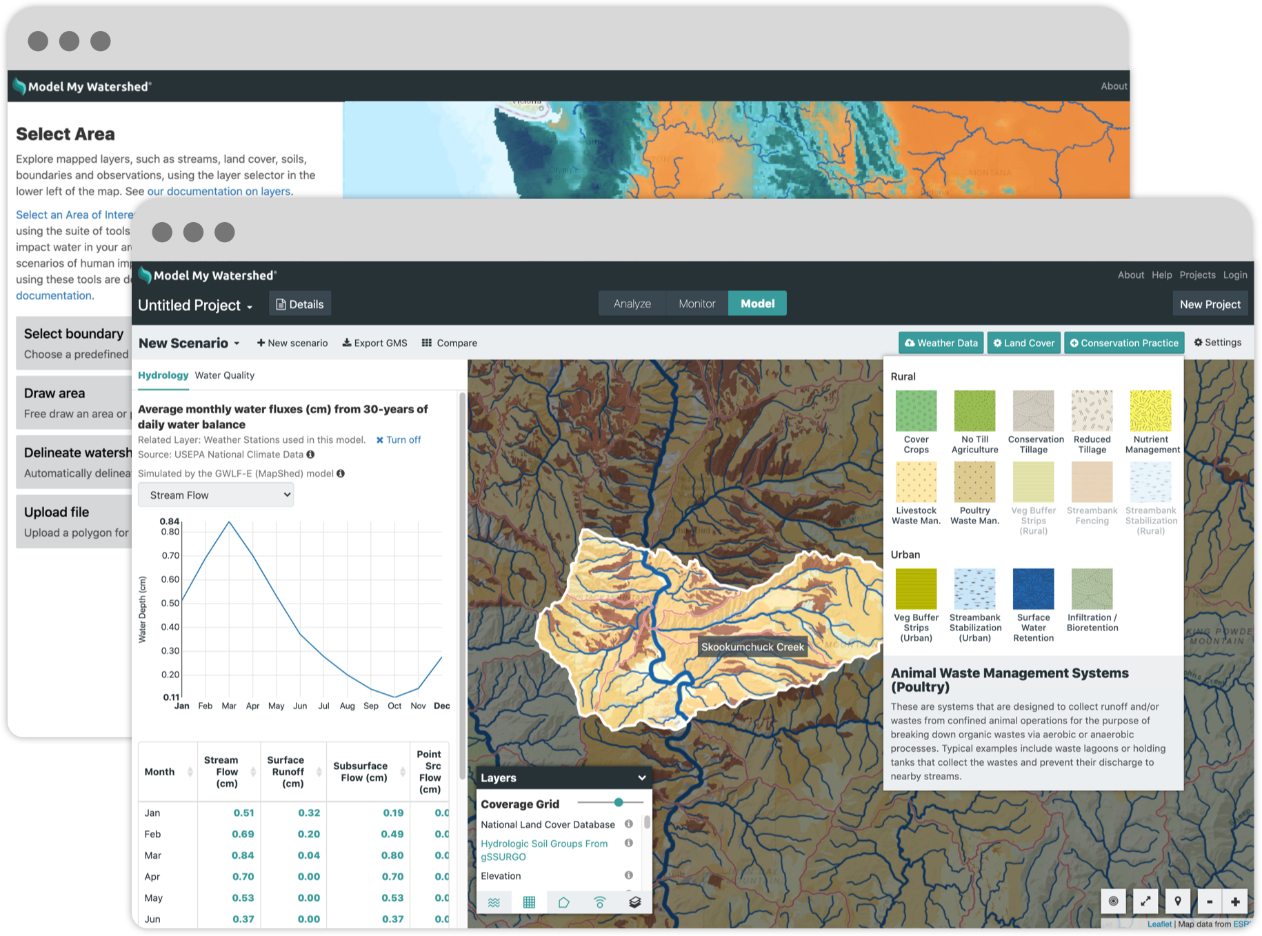
With just a few mouse clicks, users are able to select a geographic extent, analyze real land use and soil data, model stormwater runoff and water-quality impacts, and compare how different conservation or development scenarios can modify runoff and improve water quality for everyone.
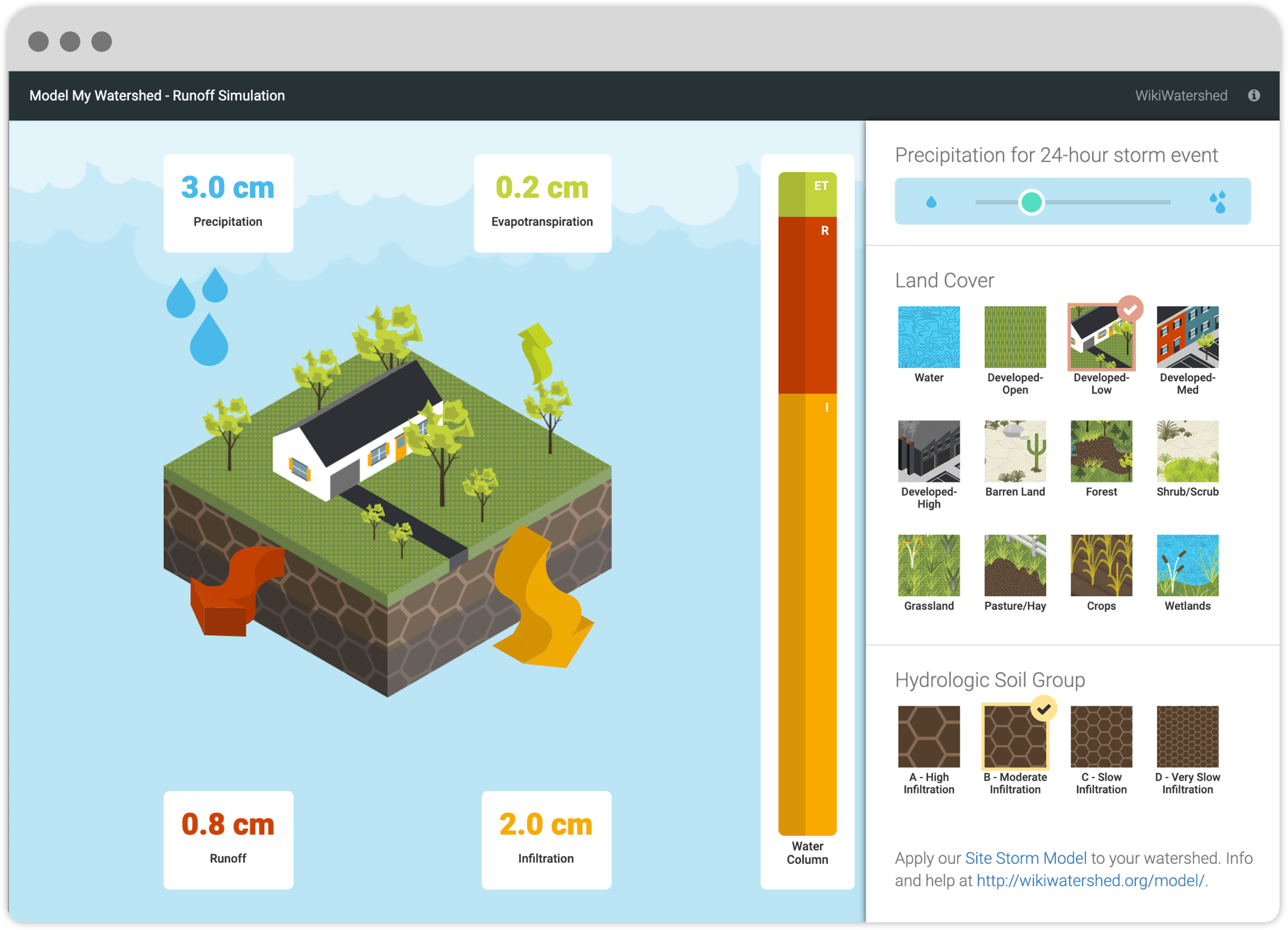
For those users who want to learn more about the basics of stormwater modeling before selecting their own geographic extents and modeling parameters, the Runoff Simulation provides a great introduction. Azavea’s GeoTrellis, an open source software library for cloud geospatial computing, enables users to process and display the complex hydrologic modeling results with sufficient speed to provide a game-like experience.
Place-based education and policymaking
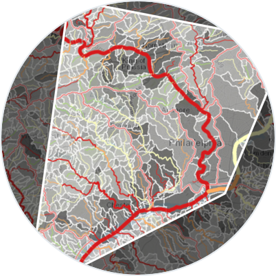
While Model My Watershed began as a web application specific to educational users within watersheds in Southeastern Pennsylvania and the Delaware River Basin, it is now an award-winning, national-scale application with a growing user community across the continental United States. Users appreciate the availability of water quality data from many data repositories, all in one place, in an easily understood workflow that is connected right to the source data.
Furthermore, its initial focus on primary and secondary education has been extended to include professional planners, government policymakers, environmental restoration experts, and citizen volunteers that want to better understand and address the impact of stormwater runoff on their communities.

From modeling watersheds to pollination management
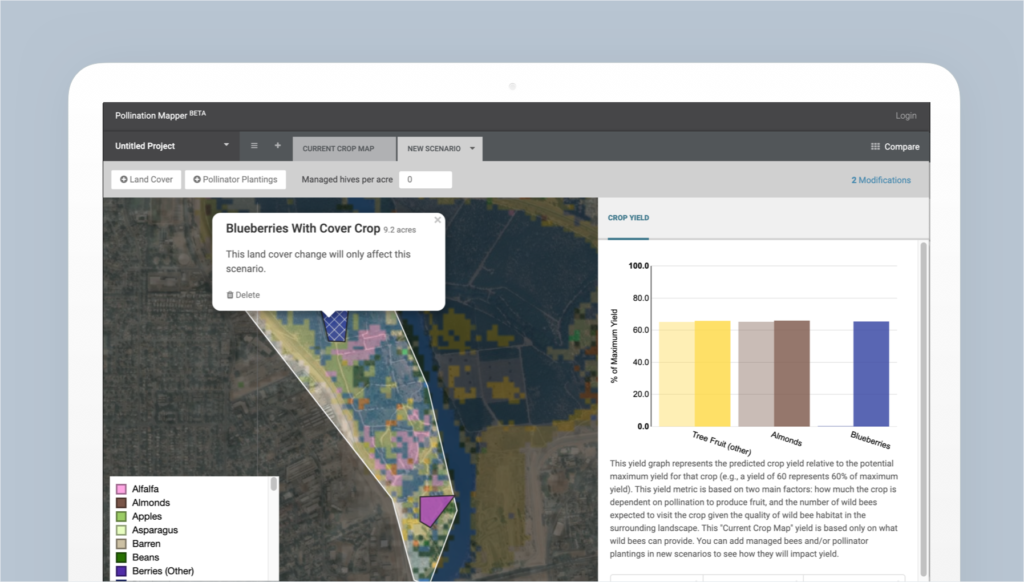
Model My Watershed’s source code was released under an open source license. This transparency, an increasingly common step for software that supports science, has enabled the software to be used for other purposes. For example, the Model My Watershed framework was adapted by Azavea and a group of researchers to build a pollinator modeling software system. Pollination Mapper enables farmers and agricultural researchers to assess the costs, benefits, and net effects of bee pollination enhancements on their farms and finances. The underlying model, data, and purpose are different, but the general workflow is similar to testing stormwater impacts on local watersheds.
Overcoming barriers to meet user needs
As a cloud-based learning and analysis platform accessible from a web browser on workstations, laptops, and mobile devices, Model My Watershed overcomes many of the cost and technical barriers to bringing environmental education to the public and important decision-making tools to communities in need.