Skip to content
Azavea
  • What We Do
  • Research
  • About
  • Blog
  • Careers
  • Contact Us
Labeled crosswalk in satellite imagery.

Company

Is This a Crosswalk?: 5 Takeaways from Training a Data Labeling Team

By Niki LaGrone on September 13th, 2019

We trained remote computer vision workers to provide data labeling for machine learning projects. Here's what we learned.
Illustration of RGB tile and RGB + Elevation tiles being transferred.

Software Engineering

Transfer Learning from RGB to Multi-band Imagery

By Adeel Hassan on August 30th, 2019

We used transfer learning to teach a model to take advantage of multi-band imagery without discarding the original RGB pre-training. This resulted in significant performance improvement.
Dedupe logo overtop of map with facility data from OAR.

Software Engineering

Using the Dedupe Machine Learning Library for Cleaning and Matching Data

By Justin Walgran on August 30th, 2019

To deal with issues of apparel facility list data quality and scale quickly and efficiently we need a machine learning tool that can capture the knowledge of domain experts, find commonalities in jumbled text, and confidently compare large lists without the need to compare each individual entry.
Ground truth imperfectly overlaying machine learning predictions.

Software Engineering

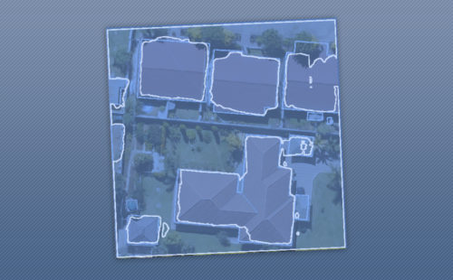
Using Noisy Labels to Train Deep Learning Models on Satellite Imagery

By Lewis Fishgold on August 5th, 2019

How do noisy labels affect the accuracy of a deep learning model? We added different amounts of noise to the SpaceNet Vegas buildings dataset and trained some models to find out.
Picture of dice overlaid with charts from Anscombe's Quartet.

Software Engineering

An Introduction to Machine Learning Accuracy Metrics

By Joe Morrison on July 31st, 2019

How accurate of a machine learning model can you make? It depends on how we decide to define "accurate".
Viridis color scheme applied to analysis of part of the U.S.

Software Engineering

Introducing WMS and WCS Support for GeoTrellis and Raster Foundry

By Nathan Zimmerman on July 3rd, 2019

Raster Foundry and GeoTrellis now support WMS and WCS standards, enabling streamlined workflows that utilize multiple data sources.
  • Previous
  • 1
  • …
  • 3
  • 4
  • 5
  • 6
  • 7
  • Next
azavea-logo-white
990 Spring Garden,
5th Floor
Philadelphia, PA 19123
(215) 925-2600
Contact Us

Company

  • About
  • What We Do
  • Research
  • Careers
  • Blog
  • Press

Services

  • Software Engineering
  • Data Analytics
  • User Experience Design
  • Big Data Processing
  • Machine Learning
  • R&D

Newsletter

Stay in touch, spam-free. Sign up
B Corporation logo.
Terms of Use • Privacy Policy • Directions
© 2021 Azavea