Deep Learning for Semantic Segmentation of Aerial and Satellite Imagery
By Lewis Fishgold and Rob Emanuele on May 30th, 2017
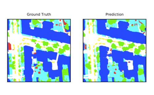
This post describes how to use deep learning to do semantic segmentation on aerial and satellite imagery, experiments on the ISPRS Potsdam dataset, and how to visualize model predictions on a map.