
Are you voting in new districts this election? We updated our free Officials & Districts tool to help you find out.
You’ve probably heard the word “redistricting” more than usual this year, especially if you’re living in places like Alabama or North Carolina. As a result of our work maintaining the Cicero database, my team closely tracks redistricting events across the world. But the details around legislative districts, like how they actually look on a map and when they go into effect, are complicated. And there are few resources to turn to if you want to see how state-wide changes affect you. This became evident this past May during Primary Elections in our home state of Pennsylvania.
Earlier this year, Pennsylvania’s Supreme Court ordered new Congressional districts to be drawn, which go into effect on January 3rd, 2019. Voting for representatives of these new districts first took place in May’s Primary Elections, though until they go into effect in January, constituents will continue to be represented in their current districts by their current Congresspeople. As a resource for our community, we publish a free Officials & Districts lookup tool that anyone can use to find out who represents them and where their legislative districts are. We were thrilled when it was linked to as a resource by Philly.com and Billy Penn before the primary election. However, because the tool showed current districts and officials, some folks that saw it were confused at their polling places when they were asked to vote for representatives in the new, differently numbered districts.
To help out, we’ve added a new feature which alerts you if your district is changing for an upcoming election, and lets you view your new districts against your current ones.
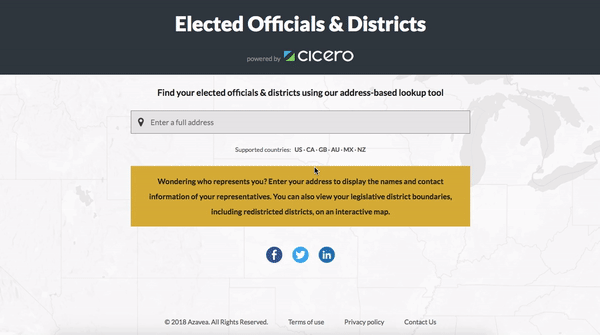
We’ve made this available for every legislative district at the National and State level in the US (as well as 8 other countries) and for 300+ cities and counties as well. So if you’re voting for officials in new districts this November, like folks in over 20 of California’s larger cities, please feel free to check it out here and let us know what you think! We hope it can be used as a resource for greater understanding around changing district shapes and how they impact representation.
And if your area is not experiencing mid-cycle redistricting this year, don’t feel left out. We plan to continue to maintain our Officials & Districts tool for the foreseeable future. If redistricting strikes your area in 2019, 2020, or beyond, we’ll be here for you.