
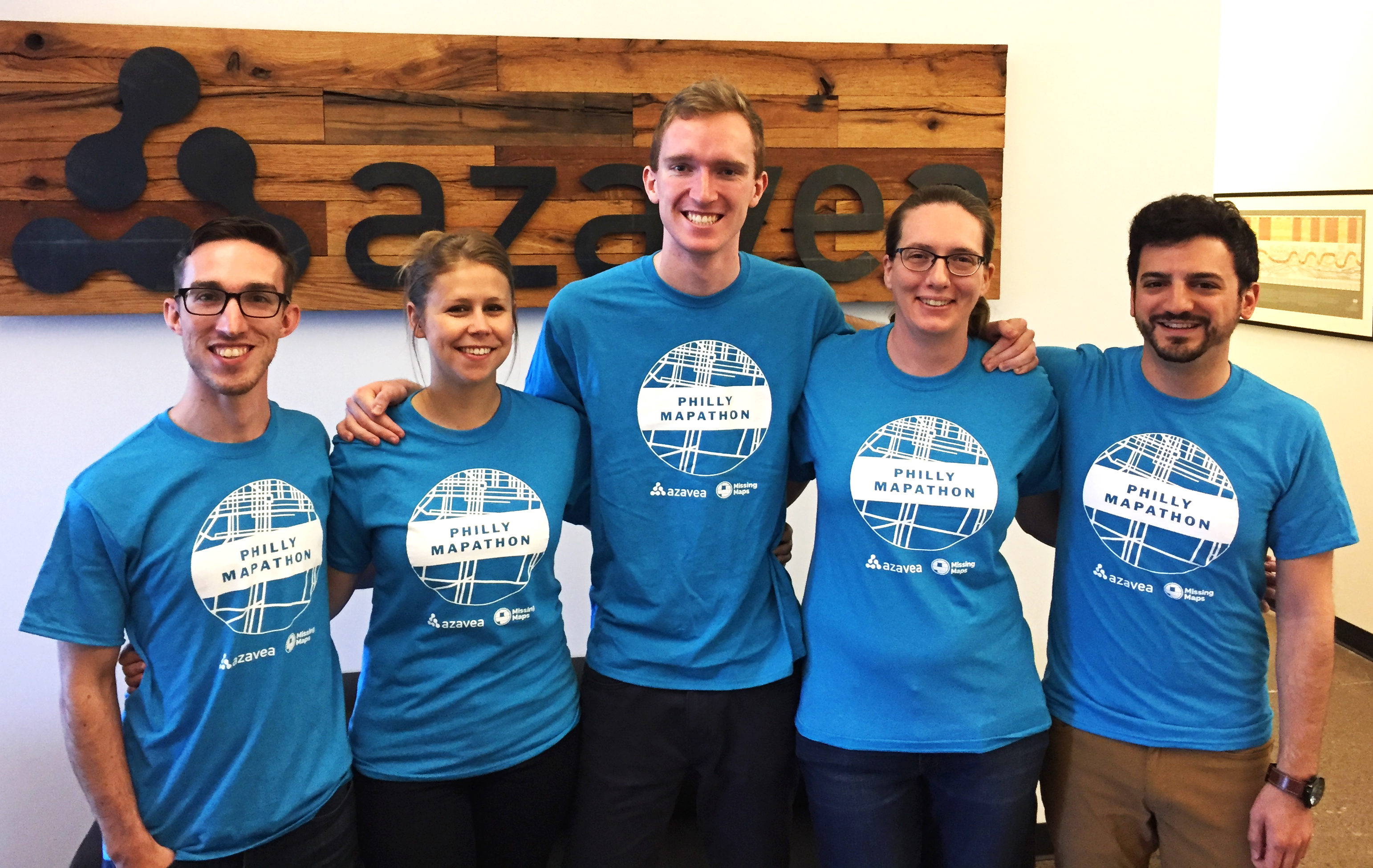
More than 65 volunteers gathered for a 4-hour marathon mapping session – the Philly Mapathon – during PhillyTechWeek to put vulnerable communities on the map.
The data that was recorded during the event will be used by NGOs like Humanitarian OpenStreetMap and the Clinton Health Access Initiative (CHAI) to plan malaria eradication interventions in Zimbabwe.
Charlotte Dolenz, Malaria Global Manager of Southern Africa for CHAI, spoke to the group about how Philly Mapathon volunteer contributions will support their efforts to eradicate malaria.
Dolenz also talked about CHAI’s work providing cohesive and targeted support to government malaria programs in Botswana, Mozambique, Namibia, South Africa, Swaziland and Zimbabwe.
Putting Buildings on the Map
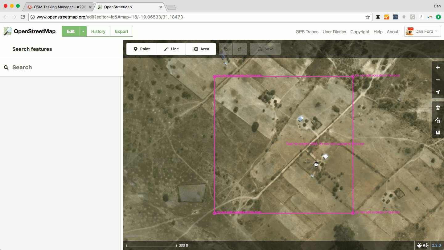
Efficient navigation is essential when NGOs are coordinating aid and relief, but these groups typically don’t have access to detailed maps in the field for developing areas. Satellite and aerial imagery is helpful, but lacks attributes like building type, street names, etc.
Adding features to the map as vector data allows NGOs to export data to run custom analyses, visualize data on a simplified, but detailed map, and use the data for navigation purposes.
Specifically in the context of malaria eradication work, the building data will be used in spatial analyses that allows NGOs to plan interventions like spraying regiments.
The Philly Mapathon Experience
A video feed of live edits and a leaderboard were displayed on large screens to provide a visualization of the group’s progress throughout the event. Volunteers filled Azavea’s community space and kitchen and enjoyed food and drinks while they worked.
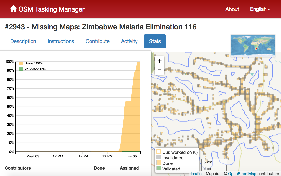
The group collectively added more than 9,200 buildings to the map in a few hours.
Top contributors were awarded prizes and raffle items, including Philly streetmap etched glasses by UncommonGreen, were given out to participants.
About 10 Mapping Mentors, or experienced volunteers, floated the room to answer questions throughout the event.
All commits were documented with the comment #PhillyMapathon so that the edits could be tracked. Final stats for the task can be found here (note that some volunteers worked on the task after the Philly Mapathon, so Mapathon totals may be different from the numbers listed on the site).
Final stats: 9,240 total edits; 9,233 buildings added to map in Zimbabwe to assist @ClintonHealth @hotosm & @TheMissingMaps #PhillyMapathon pic.twitter.com/i3Eul6CzQI
— Element 84 (@Element84) May 5, 2017
Check out this Twitter recap of the event, including pictures:
Recap of the @PhillyTechWeek #PhillyMapathon #PTW17https://t.co/EbszuXb3HZ
— Dan Ford (@DanJFord) May 5, 2017
Thank you!
Special thank you to Rebecca Firth of the Humanitarian OpenStreetMap Team for her help coordinating during the organization of the Philly Mapathon and providing great planning resources from The Missing Maps Program. Thanks to Charlotte Dolenz of the Clinton Health Access Initiative (CHAI) for taking the time to speak to our volunteers about how their contributions will be used for important malaria prevention measures.
Thanks to Patrick Hammons of MaptimePHL for his help organizing experienced volunteers and to all Mapping Mentors for answering attendee’s questions throughout the event. Thank you to Robert Cheetham for providing Azavea’s resources and community space for the event.
And thank you to all attendees who volunteered their time to help people around the world in need. You all helped to make the first Philly Mapathon a success!
Azavea was excited to organize and host the Philly Mapathon because it fits our mission perfectly – we apply geospatial technology and spatial analysis for civic, social, and environmental impact.
We hope to see you at future events!