
In 2015, Azavea was awarded two Phase I Small Business Innovation Research (SBIR) grants for a pair of related projects: Raster Foundry and ModelLab. We are pleased to announce that both projects have been funded for the next two years through two Phase II grants.
Raster Foundry will be a cloud-based platform for fast processing of satellite and aerial imagery management. It received $1,000,000 through a Phase II grant with the U.S. Department of Energy.
ModelLab will be an online tool to build, store, and execute complex geospatial models as well as support easier use of NASA satellite data. It will be supported by $750,00 from NASA.
What are SBIR Grants?
SBIR grants are a type of research and development (R&D) grant awarded by several federal agencies to small businesses in order to support invention and development of innovative technology. The program is operated independently by each federal agency, but they all share a basic structure and are organized into two phases. A Phase I SBIR grant is relatively small grant (usually $100K – 150K) aimed at testing the feasibility of an innovative idea and build a rough prototype in a short period of time (usually six to eight months). Phase II SBIR grants support the technical implementation of the innovation, and they cover a two-year time period.
Raster Foundry for Big Imagery Processing
Advances in small satellite, aerial drones, and other remote sensing technology are revolutionizing the Earth observation industry. They provide a new source of consistent, continuous data for atmospheric, ocean, and land use studies. Costs are falling while their resolution and number of sensors improve. These new data sources are tools that can be used to help solve the most pressing problems facing our planet; from climate change to biodiversity loss to agriculture to water resource management. But the technology to process this wealth of new data has not kept pace with its accelerating growth.
Raster Foundry is our response to these limitations. The tools available today were built for experts by experts and have steep learning curves and high infrastructure costs. Raster Foundry is an entirely web-based platform designed to be as easy to use as it is powerful.
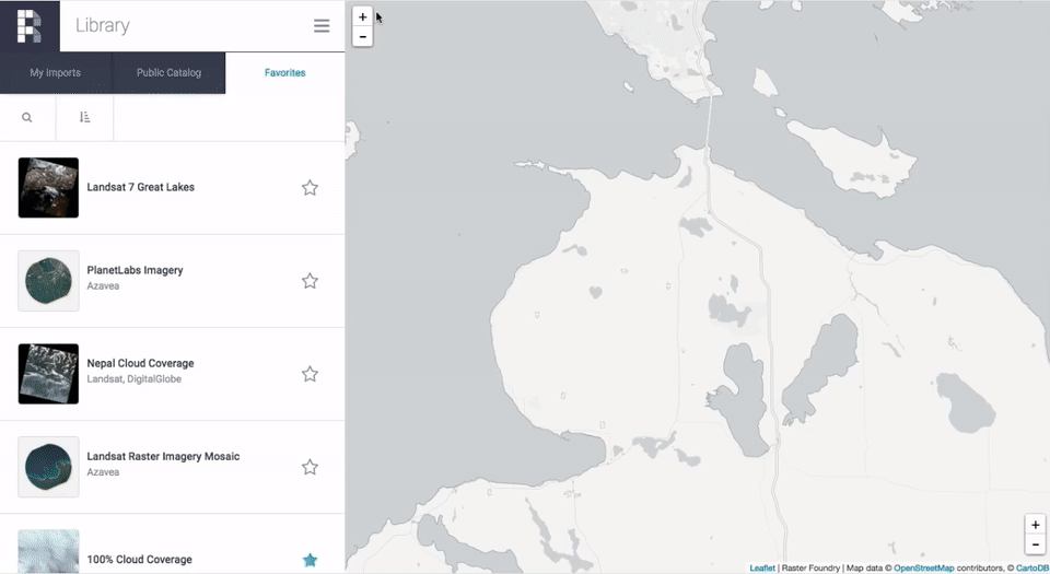
We developed an intuitive user interface in Phase I that enables non-experts to work with advanced geospatial analytical techniques. Experts will benefit from the speed achieved through distributed processing and ability to automate routine tasks, leaving more time to focus on the real challenges. In Phase II, our goals are to make Raster Foundry faster, more powerful, and more fun to use than anything on the market.
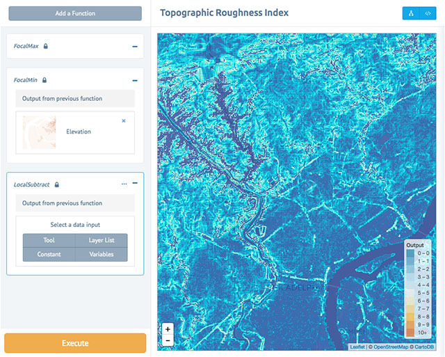
ModelLab for Intuitively Working with Satellite Data
ModelLab provides the ability to create, share, and modify geospatial models that will leverage imagery and other raster datasets. During Phase I, a demo version of ModelLab was tested by university students in an introductory GIS course, Azavea staff, and GIS professionals. We invited a group of people to help us test the prototype. They liked the intuitive interface and the ability to create models through a visual programming process with a set of simple tools. In Phase II we will incorporate the feedback from Phase I and re-build the user experience and integrate the ability to search NASA data directly. We had not expected to win both the NASA and DoE grants, but the two projects are complementary, and we believe we can use parts of ModelLab to make Raster Foundry more compelling and useful.
We’d love your help
We are excited about the potential for both of these projects. They both leverage our investment in the open source GeoTrellis framework; they advance the state-of-the-art for online geospatial analysis; and they have clear applications for positive civic and social impact.
We believe we are on the right path, but we aren’t there yet. And we want your help. Do you use remote sensing software? Do you use earth imagery? We would love to hear from you. Any information that could make Raster Foundry or ModelLab more useful to you would be valuable for us to know. And soon we will need people to help test during the Phase II projects.
-
How do you use earth imagery?
-
What do you wish you could do with imagery?
-
Want to test these products?
Send Ross Bernet (rbernet@azavea.com) or Joe Morrison (jmorrison@azavea.com) an email today!
The development of the ModelLab project is supported by the NASA Small Business Innovation Research (SBIR) program, Award Number NNX16CS04C. The Raster Foundry project is supported by the U.S. Department of Energy SBIR program, Award Number DE-SC0013134. Read more about the SBIR program here.