
much-expanded 2014 LocationTech Tour to Philadelphia this past November 20th, the GeoPhilly Meetup celebrated its first birthday! That means Sarah Cordivano and I have organized and hosted over 12 monthly GeoPhilly meetups over the past year, including ones with PhillyPUG, MaptimePHL, and even last year’s Geo Open Source conference. The event last year was so well attended and enjoyed that we decided to bring back this larger showcase and celebration of the Philly open source geospatial community again.
We kept the venue, the beautifully historic Arch Street Meeting House, and much of the same format with a slate of several talks on a weekday afternoon and a trip to the bar afterwards to hang out with fellow map nerds.
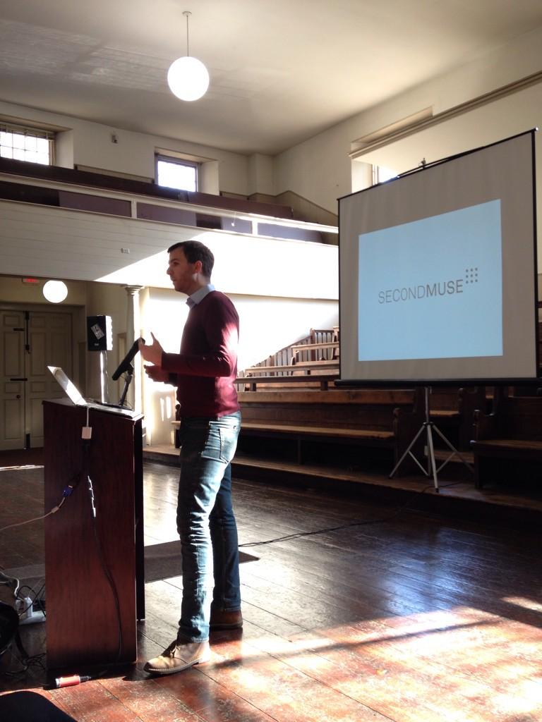
Our Keynote speaker this year, Mike Brennan from SecondMuse, “zoomed out” a bit away from our map-mania and had us examine some of the broader human elements and social structures of open source collaboration in which we develop our map-based tools. I had the good fortune to work more with SecondMuse this year on Al Jazeera’s Canvas hackathon, and it was exciting to hear more about the other projects SecondMuse is involved in globally that advance civic impact through open source collaboration. That’s a goal held close by many in our geospatial community as well.
Up next was Ingrid Burrington from Mapzen, who kept us asking questions about how we collaborate – in this case, how we all decide what to call where we are. Specifically, her talk was on gazetteers and geocoding in open source; how both of these are still hard problems to figure out; and how open source administrative and political boundary data can help.
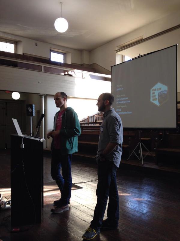
Ryan Arana and Josh Yaganeh came all the way from Esri’s Portland R&D center and gave a talk on a new open source tool they built, GeoBin.io. GeoBin.io is useful for playing with and inspecting GeoJSON data sent over HTTP, and uses some cool technologies in the form of WebSockets and Go.
[iframe src=”http://www.youtube.com/embed/H_eC1lhJe9Q” width=”100%” height=”480″]
Lauren Ancona, our first Philly “civic hacker” of the day and who recently started as a Data Scientist at the City, spoke next about her obsession with parking data and mapping parking rules in Philadelphia using open source. She encouraged us to try and help out with parkadelphia.org, and fielded some inspiring and candid questions about what it’s like being a beginner in maps and civic hacking and how to keep getting better at it.
[iframe src=”http://www.youtube.com/embed/uAqlFRwiD0g” width=”100%” height=”480″]
Our second local civic hacking (or civic mapping?) project was presented by James Tyack. His project UnlockPhilly.com is also based around transportation and crowdsourcing reports like Lauren’s parking projects, but focuses on accessibility for city dwellers with disabilities, who often have considerable barriers to getting around town every day. James shocked us with examples of how even mapping apps aimed at accessibility concerns can even be inaccessibly designed themselves – a concern which Sarah recently blogged about.
[iframe src=”http://www.youtube.com/embed/yGr1mH57ubw” width=”100%” height=”480″]
Azavea’s own Rob Emanuele gave the penultimate talk of the evening on recent improvements to GeoTrellis – our high performance processing library for very large raster data – that take advantage of Apache Spark to process data stored in Accumulo. The combination can serve map tiles from very complex datasets like land cover types for the whole USA, or global climate change models very quickly for snappy web applications.
Our final talk of the evening was by Matt Amato from AGI, who spoke about the Cesium project and gave examples of the power inherent in time-dynamic geospatial visualizations. As geographers focused on visualizing place, we sometimes have more trouble visualizing time. Web geodata formats like GeoJSON and KML don’t always make the best accommodations for temporal data, and that’s where Cesium’s CZML standard comes in. Matt wowed us with WWI battle maps and car traffic simulations incorporating an aspect of time.
After a set of talks this cool, our group was excited to head to the Buffalo Billiards bar to talk about what we had learned. We had 94 attendees come for the afternoon – 1 more than last year! – and even more show up for the evening. It has been a fun first year with the GeoPhilly community and I’m looking forward to the next twelve months as we continue growing in numbers, skills, and maps!]]>