
Last year saw the rise of the #geohipster hashtag, #maptime meetups and continued expansion and adoption of OpenStreetMap. Here are five exciting geospatial software apps and tools released in 2014 and sure to grow in 2015:
Morgan Herlocker at Mapbox left us with perhaps the greatest Christmas present of all in late December, geoprocessing in the browser. Turf is a javascript library for performing common geospatial functions such as buffering, merging or calculating centroids. One of the nice features of Turf is that since it runs in the browser, it can run completely client-side and offline so it doesn’t need to connect to an external API. It’s modular too, so you include only what you need in your web app. Coming soon: the end of the spatial database as we know it?
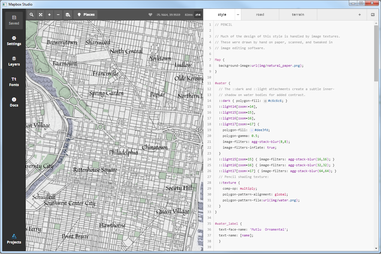
Also from Mapbox, 2014 saw the release of Mapbox Studio, a major upgrade to the desktop based Tilemill software. Like Tilemill, Mapbox Studio allows you to add data (such as shapefles, geojson, csv) and style it using CartoCSS. But it also makes connecting to and styling Mapbox’s streets, terrain and satellite data extremely easy – it’s streamed right into the application. Source data can also be streamed from data stored in your Mapbox account. One of the nice features is the color picker, which essentially eliminates the need to figure out what hex code to add, you can simply choose the color and it will do the rest. Along the same lines, typography took a big step forward in Mapbox Studio with over 300 fonts built-in, selected for their use with digital cartography. As always, you can add your own custom fonts as well.
Taking story maps the next level, Odyssey.js was released by CartoDB in the summer. Inspired by experiments in interactive storytelling like the excellent New York Times Snow Fall project, Odyssey is a javascript library for developing interactive map-based stories. There’s also a convenient web-based editor and a number of templates, which allows anyone to craft a professional interactive story in minutes. But of course it’s also an open source javascript library, so developers can build their own custom interaction with ease.
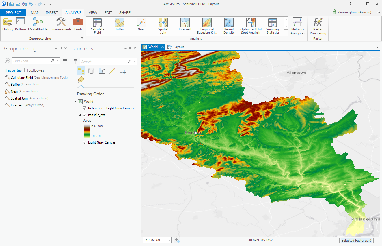
You can’t spell ArcGIS without GIS. In 2014, Esri released a brand new desktop software application called ArcGIS Pro. It’s a major overhaul to the Esri desktop ecosystem, and while not meant to replace ArcGIS Desktop (merely supposed to work alongside it), I can’t see how it wouldn’t in time. It’s a new multi-threaded 64-bit application with a fresh user interface for visualization and analysis. It’s available in beta now and the official release is anticipated for this month. The beta is fairly robust, with fast rendering and much-improved color palettes and symbology options, and though the ribbon interface (similar to Microsoft Office) is simpler it takes some time getting used to. Pro has a streamlined interface for working with data stored in ArcGIS Online. I’m hoping to see some features released soon that will make it easier to work with open data and formats.
Unmanned aerial drones were in the news for a lot of reasons in 2014, but mostly because of Amazon. However, with the launch of OpenDroneMap, there will soon be an open source toolkit to process civilian drone products. As of now, it can only process point clouds, but the project is active on GitHub and expects to have tools to process and upload high-resolution imagery, digital elevation models and other data.
Though not a new GIS tool in 2014, the Humanitarian OpenStreetMap Team did some amazing work mapping the Ebola outbreak in West Africa and improving map coverage of the Philippines after Typhoon Haiyan. 2014 was a big year for spatial with open geo taking off and satellite data becoming more attainable than ever. With a track record like that, 2015 should be an exciting year.