
After months of work, we are pleased to announce the launch of the beta version of OpenTreeMap Cloud, our new cloud-hosted collaborative platform for crowd-sourced tree inventory, ecosystem services calculations, urban forestry analysis, and community engagement.
OpenTreeMap helps communities work together to map and explore the urban forest. We launched OpenTreeMap as an open source project in 2011 and are thrilled that it’s now in use in ten different locations across the United States and Great Britain. OpenTreeMap is still available as an open source project that can be implemented by anyone who has development skills, but we realized that we needed to make the software into a more flexible, lightweight system that could easily adapt to meet the needs of a community with 1,000 trees or a 1,000,000 trees.
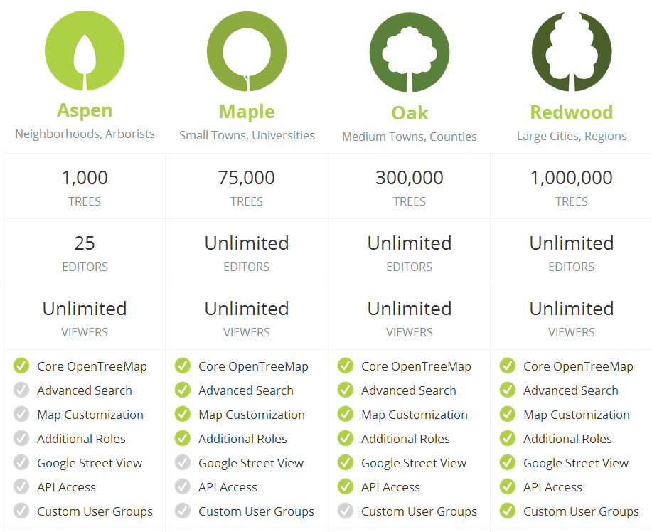
OpenTreeMap Cloud provides that flexibility by enabling users to sign-up for one of four monthly subscription plans. Each plan supports the addition of a certain number of trees to a map and includes a corresponding list of features. A neighborhood association or local school might want to sign up for the Aspen plan, which includes 1,000 trees and the basic OpenTreeMap mapping and searching functionality. A larger city might choose the Oak plan, which includes up to 300,000 trees and additional customization options, access to the OpenTreeMap API, and other features.
Since OpenTreeMap Cloud is now hosted in Amazon Web Services, we streamlined the sign-up process and gave more control to the map owner. Rather than spending weeks coordinating with our software developers on the construction of the map, users can now go through a few quick steps to identify their map’s name, location, and subscription level. Then they simply click the “Create Map” button and start adding trees. Map owners can further customize their map by uploading a logo, selecting colors, creating custom data fields, and providing different editing privileges to certain user groups.
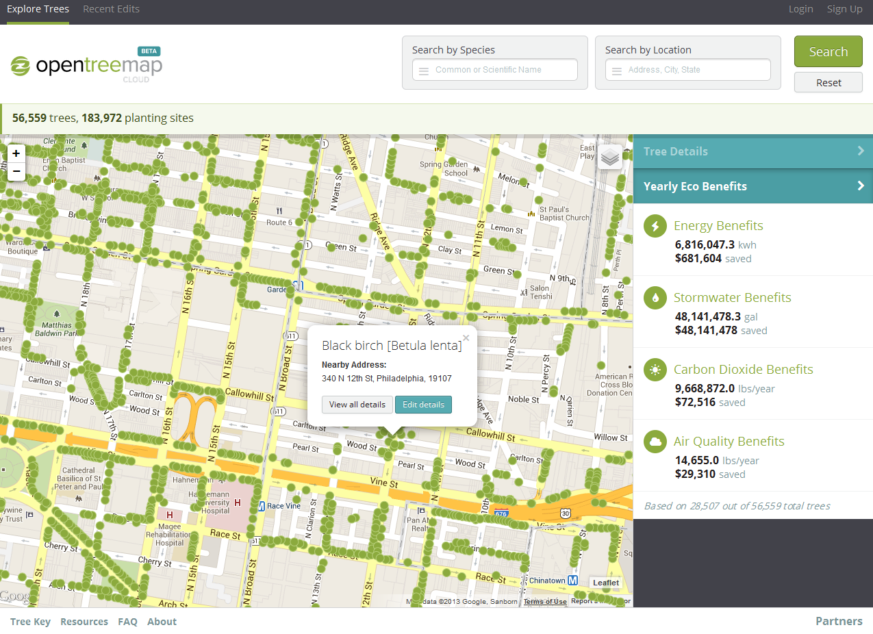
OpenTreeMap Cloud includes the same functionality as the original project (add and edit trees, upload photographs, search and export tree data, calculate eco benefits), but we have some exciting new features in the works. Over the next year, we plan to add a mobile app that can be accessed as part of the monthly subscription, support for tracking green infrastructure features such as bioswales and green roofs, a bulk upload system for importing existing tree inventories, social media sharing, and a set of games and badges, among other features. A full list of the planned functionality is available at https://opentreemap.org/pricing/detailed/.
Currently, we are inviting users to request an invite to a private beta of the OpenTreeMap Cloud. Beta users will have access to a one-month free trial to explore the software and provide feedback on how it might be improved. Invites can be requested on the OpenTreeMap website at www.opentreemap.org.
Thank you to the USDA National Institute of Food and Agriculture who partially supported the development of OpenTreeMap Cloud under Agreement No. 2010-33610-20937 and 2011-33610-30862 of the Small Business Innovation Research Grants Program.