
Mapping all of the trees in the six county region around Sacramento, California or the thirteen county region around Philadelphia might sound ambitious. How would it be possible to gather all that data? If a multi-county region sounds difficult, mapping the trees in an entire country might seem just about impossible. A group of researchers from The Open University in Milton Keynes, England, however, think that it’s worth a try and are using OpenTreeMap for this tree data gathering citizen science initiative.
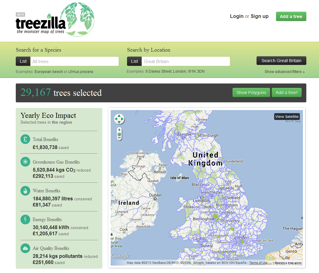
For the past few months, we’ve been hard at work on Treezilla, the monster map of Great Britain’s trees. Organized by The Open Science Laboratory at The Open University in partnership with Treeconomics and Forest Research, the Treezilla site encourages users to enter information on trees in England, Scotland, and Wales. The goal is to create a data rich platform that researchers and the public can use to conduct other citizen science investigations.
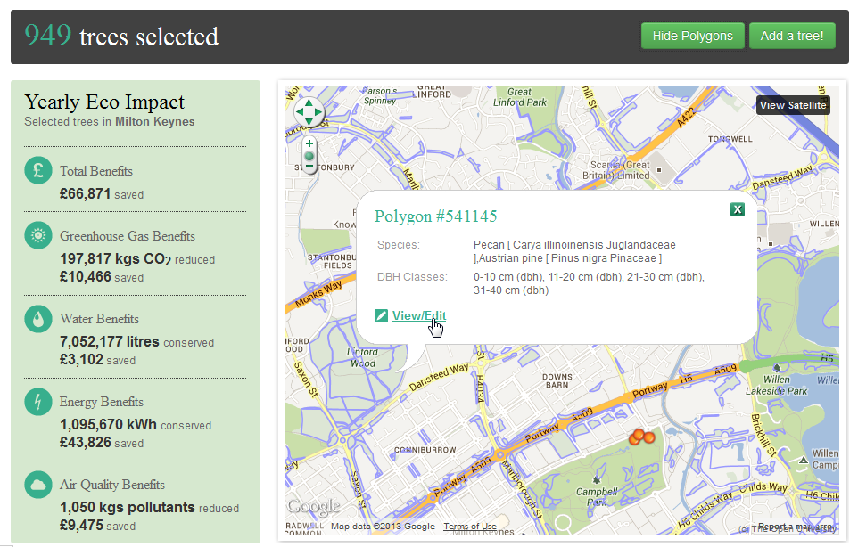
Treezilla includes many of the features found on other tree maps, but we built a few new items into OpenTreeMap to support the project. In addition to tracking species, diameter, and other standard tree information, users are encouraged to note any pests and diseases they might see on the trees as a way to help draw attention to possible health issues. We’ve also created an option for users to add data related to a polygon rather than a single point that indicates a tree. Various groups in Great Britain track information related to woodland areas or collect data based on sample plots. Adding support for polygons enables us to include that data.
Perhaps the biggest OpenTreeMap change included in Treezilla is a feature that enables administrators to upload existing tree inventories and species lists. Previously, the bulk uploading of data could only be done by a software developer, making it difficult for inventories to be added to tree maps from a variety of sources. With the new importer feature, the Treezilla administrators can gather inventories from local councils and other organizations and then gradually add them to Treezilla. When you’re trying to map an entire country’s trees, compiling existing data into a single website is a great first step.
Treezilla launched in June, and we’re excited to see the project grow and become a larger part of The Open Science Laboratory. Aside from Treezilla, we’ve also been hard at work developing mobile apps for several existing OpenTreeMap sites and building a tree map for another organization that will enable users to track information related to green infrastructure features such as bio-swales, green roofs, and rain barrels as well as tree data. We’ve also released the open source code for developing an OpenTreeMap Android app to assist groups who might be setting up their own tree map and want to use smart phones to update their map.
Our most exciting new development, though, is our soon to be launched subscription service. Designed as a cloud-based system, this second generation version of OpenTreeMap will include some brand new features such as a redesigned interface, more data field customization options, and eventually gaming, leaderboards, and badges. Organizations will be able to try out the system in a free basic version and select from a number of subscription levels available for a monthly fee. We’re aiming for an October 2013 launch and will have a website with more info available soon. If you’d like to receive announcements, you can sign up at www.azavea.com/opentreemap.
Work on the OpenTreeMap software is partially funded by the National Institute of Food and Agriculture, U.S. Department of Agriculture, under Agreement No. 2010-33610-20937 and 2011-33610-30862 of the Small Business Innovation Research Grants Program.