
2012 was a great year for OpenTreeMap, our open source project for collaborative urban tree inventory. Mobile apps, new tree maps, additional grant funding, and a whole lot more made it a busy twelve months for Azavea’s urban forestry team. Since January is all about reviewing the past and planning for the future, we wanted to give you a summary of what we’ve done and what you can expect in the next year.
OpenTreeMap in 2012
- Webinars and Tutorials – With more people exploring OpenTreeMap, we wanted to share some of our experiences and feedback about designing and using the software. Over the course of the year, we held five urban forestry webinars and made a couple screencasts. Links to all the recordings are available at OpenTreeMap.org and on our YouTube account.
- Growing the OTM Community – One sign of a healthy open source project is an active group of developers supporting the initiative. As a way to build that community, we’ve launched a mailing list for people working with the OTM code and are publishing release notes for every new version of the project. Check out the OTM wiki on Github for more info.
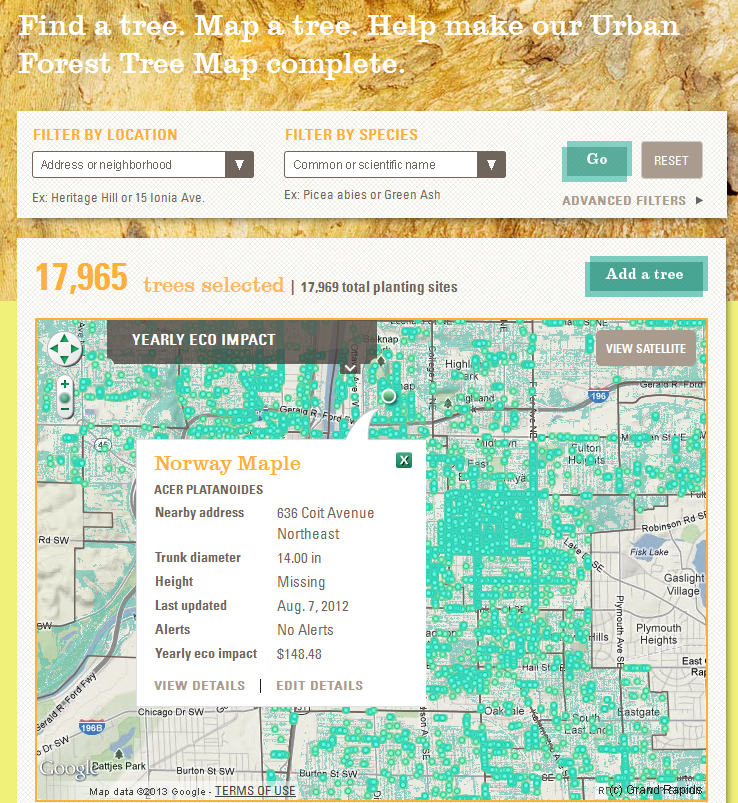
- Grand Rapids Urban Forest Project – This past summer, we were fortunate enough to develop the tree map portion of Grand Rapids’ amazing new outreach and community engagement project. With tree mapping parties, neighborhood plantings, and a spiffy blog cataloging it all, the Friends of Grand Rapids Parks’ crew has some exciting ideas about how to use OpenTreeMap.
- Mobile Apps – In the fall, we completed the iOS version of OpenTreeMap which enables users to explore, add to, and edit tree data from their iPhones and iPads. Mobile apps are currently available for PhillyTreeMap, Urban Forest Map, and GreenprintMaps.
- Other Tree Maps – San Diego Tree Map launched this year and we know other cities across the country are hard at work on their own tree maps. In addition to the Grand Rapids map, we’ve also started building a couple other maps that aren’t quite ready for their public debut. They include some exciting new features, so stay tuned for more details soon…
OpenTreeMap in 2013
- Android Mobile App – Take heart Android users! We’re finishing up the Android app version of OpenTreeMap and hope to make it available in the next couple months.
- Integration with our Forestry Modeling Tools – In 2012, we were awarded grant funding from the USDA SBIR program to further develop our tools for forestry modeling and prioritization. Part of that funding will go toward integrating that project with OpenTreeMap.
- More Maps – We can tell you more soon, I promise!
- Additional Webinars and Training Materials – We’ll be holding more webinars in 2013 and hope to build out our video tutorials and other documentation.
- A New Marketing Website – To accommodate all of this new training materials and webinars.
- Cloud Subscription Version – Perhaps the biggest and most exciting news is that we are hard at work on a cloud-based version of OpenTreeMap. We’ll make more details available in the future, but we’re very enthusiastic about the opportunity to move to a more flexible, lightweight system that can adapt easily and effectively to the needs of a community with 1,000 trees to 1,000,000 trees.
Want to know more about our future plans for OpenTreeMap? Email me at dboyer@azavea.com for the latest updates.
Work on the OpenTreeMap software is partially funded by the National Institute of Food and Agriculture, U.S. Department of Agriculture, under Agreement No. 2010-33610-20937 and 2011-33610-30862 of the Small Business Innovation Research Grants Program.