
Earlier this fall, we were pleased to learn that we had been awarded a Phase II Small Business Innovation Research (SBIR) grant (No. 2012-33610-19997) from the United States Department of Agriculture National Institute of Food and Agriculture (NIFA) to fund additional software engineering research and developed related to urban forestry.
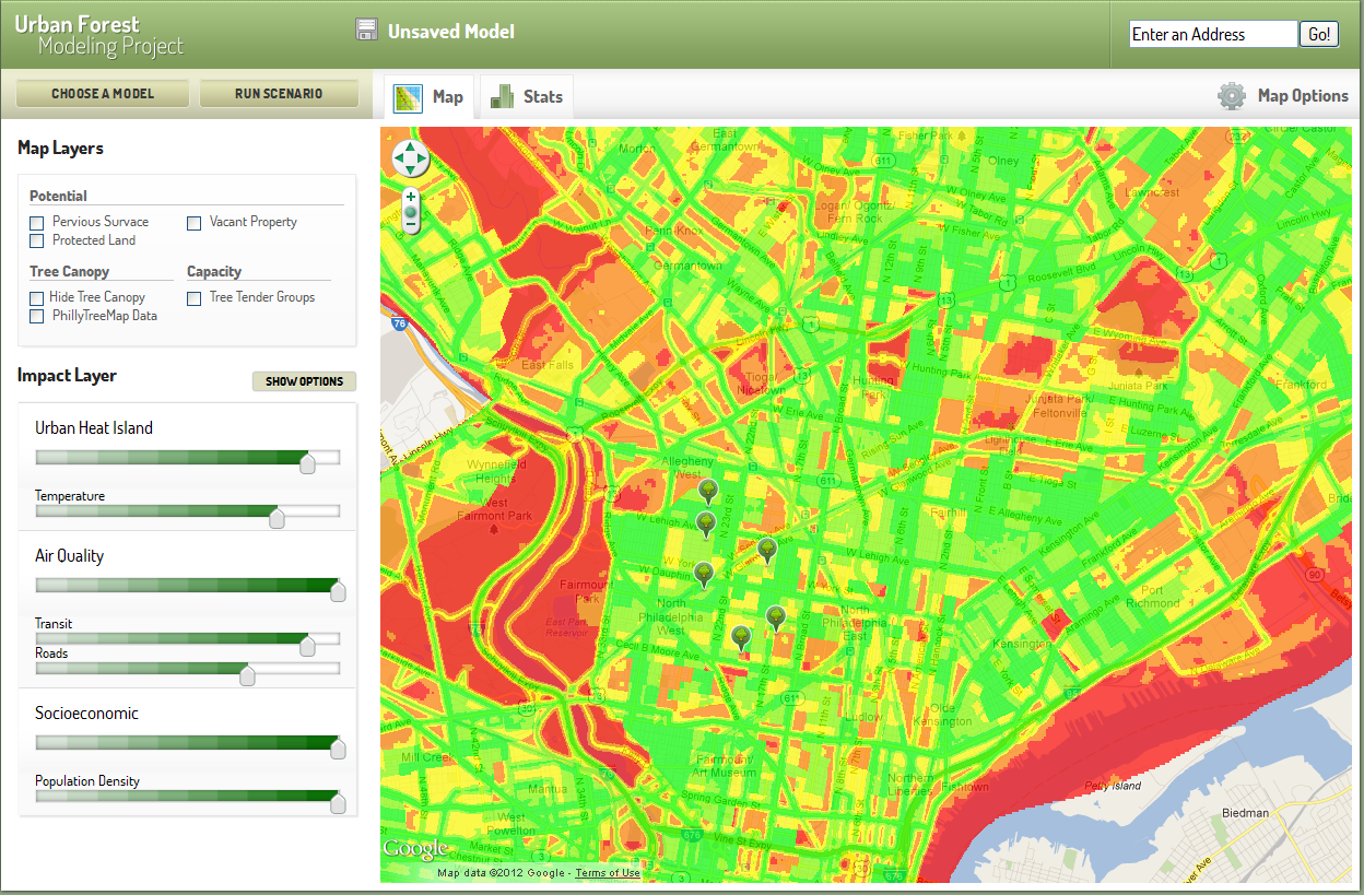
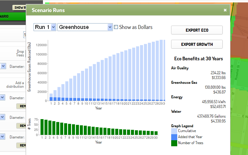
In 2011, we received a SBIR Phase I grant (No. 2011-33610-30511) from the USDA to create software that would enable users to select priorities (such as decreasing urban heat island effect, assisting with stormwater management, etc.), weight the importance of that priority, and then view a heat map indicating optimal tree planting locations based on those priorities. Users could also select different species and sizes of trees and digitally “plant” them in a variety of geographic locations. With the click of a button, the software would apply growth and mortality algorithms to determine the number of trees that would survive over a thirty year period and model the long-term ecosystem and financial benefits of those trees.
The recently awarded SBIR Phase II grant provides $450,000 over two years to improve our initial prototype developed in Phase I. In particular, we hope to expand the software to include national data sets that influence planting locations, integrate the tools with OpenTreeMap (our software for collaborative tree inventory), utilize the resources of GeoTrellis (our high performance geoprocessing framework), and add more customization options to meet the needs of different communities. You can learn more about our urban forestry prioritization and modeling tools at www.azavea.com/forestry or by viewing our introductory webinar at https://www.azavea.com/blogs/atlas/2012/06/recorded-webinar-exploring-urban-forest-modeling-and-prioritization-tools/
Since 2010, Azavea has focused on exploring how technology and web-based software can assist with maintaining and expanding our urban forests. The trees we plant in our communties, after all, play a crucial role in improving air quality, managing stormwater, reducing energy use, and creating generally healthier communities. Web and mobile tools, like our OpenTreeMap software and the modeling and prioritization tools, will hopefully help governments and community groups care for those trees more efficiently and effectively.
SBIR grants have provided us with funding for several of these projects. The SBIR grant program allows federal agencies to fund projects at small, private high tech companies when those projects align with federal departmental priorities and have larger commercial viability. We received Phase I and Phase II SBIR grants to support the development of OpenTreeMap. We’ve also received SBIR funding to develop HunchLab (our web-based tools for geographic crime analysis) and DecisionTree (our geoprocessing work that has become GeoTrellis). For more information on SBIR grants, read our “What the Heck is…an SBIR?” article from a previous Azavea Journal.