
 When we think of geopolitical conflict quite a few areas come to mind, but one quite significant and often overlooked area is the Arctic. As the landscapes of the northern latitudes transform — most significantly due to climate change — geographers and mappers will have their work cut out for them recording those changes and helping to explain what they mean for the rest of the world.
Former Alaska Lt. Governor Mead Treadwell gave a talk about mapping the landscape of the Arctic at the 2015 Annual Association of American Geographers Conference on Tuesday in Chicago, IL. Treadwell has a long history of involvement with business and environmental interests in Alaska and the Arctic region. Prior to being elected Lt. Governor, he served on the United States Arctic Research Commission and managed the Exxon-Valdez oil spill response for Cordova, Alaska.
Changes in the geography of the Arctic related to climate change will have many profound impacts. For one, oil exploration is sure to increase with less sea ice to contend with. Bathymetric mapping explorations are continuing to cover more of the sea floor as well. As sea ice recedes, shipping channels are opening up, including a link between East Asia and Europe that previously required routing ships through the Panama Canal. These journeys can now be completed more efficiently and throughout a longer portion of each year by re-routing through the Arctic.
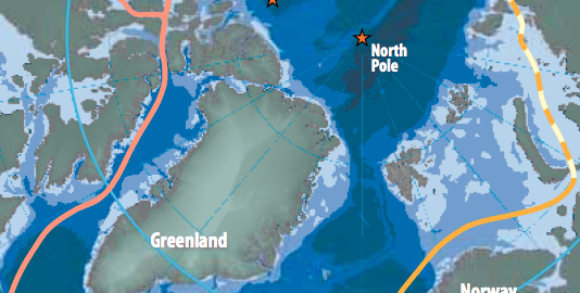
Climate change and shifting geography in the Arctic also has implications for the U.S.-Russia relationship. Russia has made it well-known that it would like to expand its territorial claim to the Arctic, and as Treadwell pointed out in his presentation, Russia is much further behind the U.S. in releasing scientific data to the public. Treadwell emphasized the need for a science agreement with Russia so that the data they collect be made available for research. As of late last year, Russia was planning to apply to the United Nations Commission on the Limits of the Continental Shelf to expand its claim on the Arctic by about 463,000 square miles. This great graphic from The New York Times shows the current territorial claims from each nation with a border claim in the Arctic.
Finally, Treadwell emphasized the importance of maintaining place names and languages. There’s an incredible amount of data contained in historic place names. Alaska’s legislature recently made twenty native languages official, granting them parity with English.
Above all else, Treadwell urged geographers and the public at large to pay attention to what takes place in the Arctic, though it might seem far away to those living in the lower 48, it’s extremely important to our future.