
As we’re all adapting to either working from home and other physical isolation tactics, the theme of 2020 so far seems to be adaptation. With Earth Day approaching, we thought it might be helpful to provide those involved in climate adaptation efforts with a quick start guide to using Temperate to create their Global Covenant of Mayors (GCOM)-compliant climate vulnerability assessment.
Temperate is the low-cost climate change adaptation planning tool, developed by Azavea in conjunction with ICLEI Local Governments for Sustainability. Temperate helps small- to mid-sized American communities navigate the process of climate change adaptation planning, including exploring climate hazards, creating vulnerability assessments, and crafting action plans. We worked to demystify and simplify the process of creating a climate vulnerability assessment, so much so that users have referred to it as the TurboTaxTM for vulnerability assessments. Follow the steps below to start yours today.
A step-by-step guide to creating a vulnerability assessment with Temperate
Step 1: Set your plan’s area of interest
Determine at what level you want to create your vulnerability assessment. It could be for your city or town, your county, or local level (as long as it is less than 10,000 sq miles).

Step 2: Invite collaborators
Create an account and invite others that will be working with you on the assessment. Keep in mind that you’ll want to invite people that will need access to the climate data, charts, and maps in order to help you make the assessments.
Step 3: Identify your area’s top hazards
Use the Top Hazards provided by Temperate to help you prioritize your assessment. These are based specifically on your location and compare historical data to the average projected data for near term (2025-2035).

Step 4: Identify aspects of your community most at risk
Select Community Systems that might be most impacted to further focus on high priority areas. Maybe your community is particularly concerned about agriculture or housing access. You can incorporate these priorities into your assessment from the start.

Step 5: Assess hazard exposure and impact
Start assessing your potential exposure using the temperate and precipitation data provided, and think through the possible impacts. Refer to other sources for additional information, including sites like Georgetown Climate Center’s Adaptation Clearinghouse, Surging Seas, and the National Climate Assessment. Be sure to involve community members in your assessment at some point in the process– they are a critical resource and source of information.

Step 6: Consider your community’s adaptability
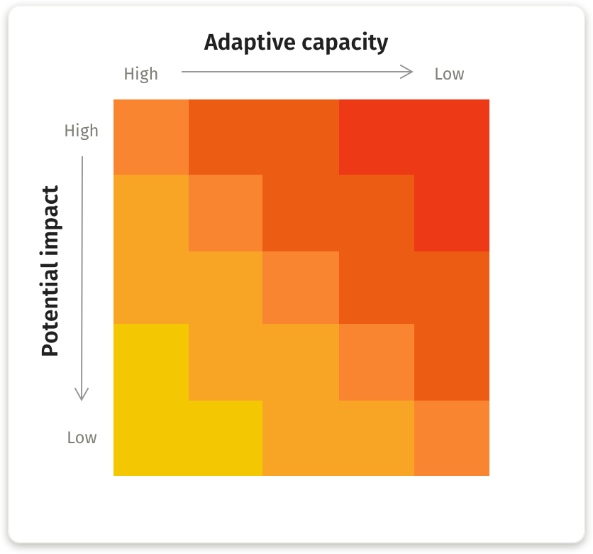
Determine how prepared your community is to adapt to each risk factor. By looking at the potential impacts of climate change together with your community’s ability to adapt to it, the highest priority areas that require early effort should reveal themselves fairly quickly.
Step 7: Repeat steps 4-6 for each risk
Work through assessing each risk in Temperate to compile a vulnerability assessment that’s GCOM-compliant.

Getting started with Temperate
Once you have completed these seven steps, your town will have the tools you need to plan and adapt. Getting started with Temperate is easy — simply sign up for an account and start your free 15-day trial. Contact Jesse Carpentier at ICLEI with any questions or if you’d like assistance putting together your assessment, facilitating stakeholder workshops, developing an adaptation plan, or identifying funding mechanisms.
Look for added functionality to Temperate soon. Right now we’re putting the finishing touches on some enhancements, including the addition of several maps regarding wildfire hazard, air quality, and precipitation (some of which are currently limited to California locations). Stay tuned for updates!
Interested? Start your free 15-day trial today! Or contact us with any questions.