Empowering Citizen Scientists with FieldScope
FieldScope is an innovative map-based data collection and analysis platform that supports citizen and community science projects and other initiatives with tools to collect data from dispersed geographic locations and to analyze trends, patterns, and change over time, including the impact of interventions. It was originally developed at the National Geographic Society, then acquired by BSCS Science Learning, a non-profit organization on a mission to transform science education through research-driven innovation. When BSCS acquired FieldScope, they envisioned the platform as a tool for not only supporting projects that want to collect and manage data from dispersed geographic locations, but also as a powerful support for learning with data, by classrooms and other audiences.

The user base for FieldScope had grown over a decade, but to continue to serve its users and pursue their vision, the new platform stewards at BSCS realized they needed to involve a firm like Azavea to modernize FieldScope and adopt more tools for data entry, management and engagement.
The Need to Engage with a Geospatial Technology Expert
BSCS came to us with the goal of improving their user experience to better support a wider range of projects and modernize the front-end and back-end. The projects hosted in FieldScope are dependent on geospatial data, therefore it was necessary that they find a team with significant geospatial skills to build and implement the technology needed to support these projects. Azavea’s extensive experience developing and enhancing interactive data-driven mapping solutions with intuitive user workflows that engage the public made us the right partner for this project. Ultimately, our work with BSCS included identifying critical infrastructure updates, redesigning the user workflow, and writing a modern frontend UI.
Modernizing FieldScope to Expand Its Reach and Improve UX
While most of our work focused on updating infrastructure and migrating existing projects, another element of this upgrade was focused on improving functionality and resources for their user base. Prior to approaching Azavea, the team at BSCS went to their existing users to identify their pain points and find how FieldScope could better support their projects. From that research, BSCS laid out the following priorities to enhance their existing user interface:
- Redesign user workflow
- Expand toolsets
- Modernize frontend and replace Adobe Flash/Flex components
- Add support for mobile devices
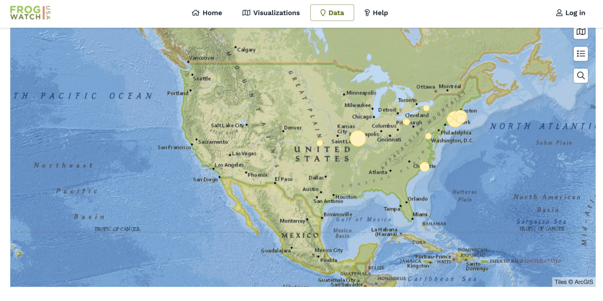
FieldScope Projects
Today, FieldScope has over 30 active projects with participants that have contributed 203,000 observations as of the end of 2021. Current projects span subject areas such as water quality, plant phenology, astronomy, trash cleanup results, cultural documentation, and more. Below are some examples of FieldScope project partnerships:
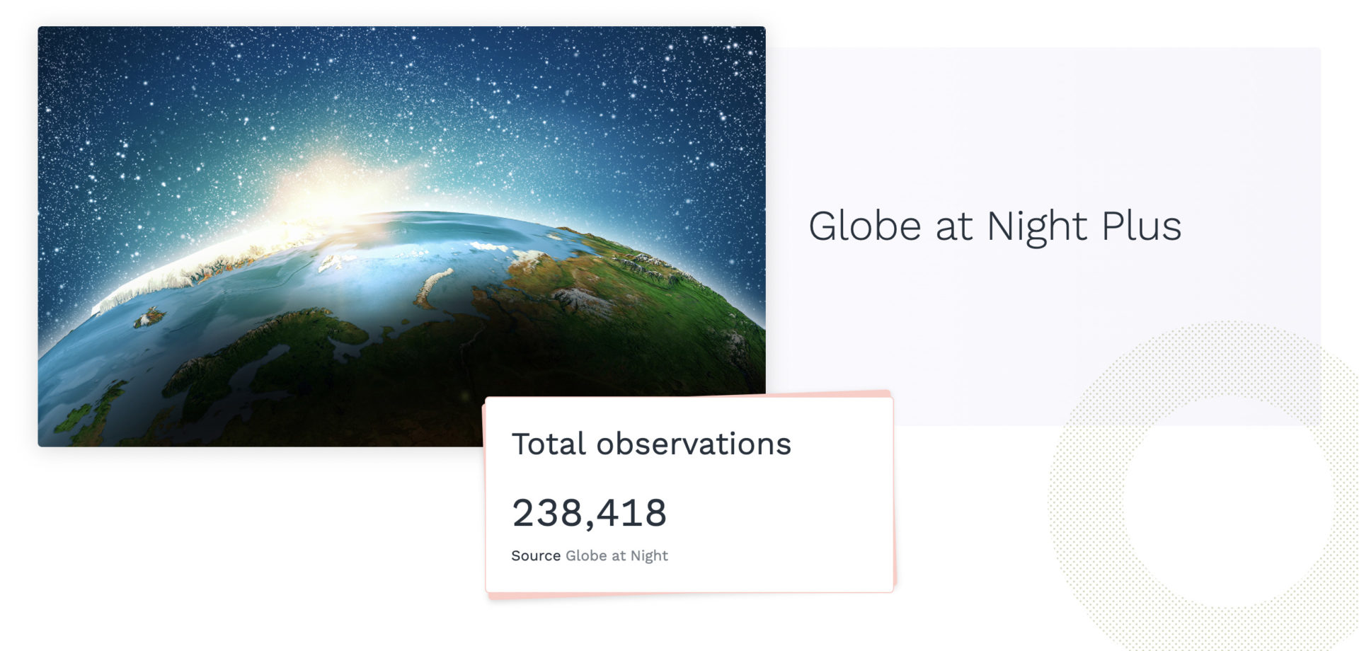
Globe at Night
The Globe at Night program invites citizen scientists to measure their night sky brightness and submit their observations from a computer or smartphone. The program has had participants from 115+ countries. More than 100,000 measurements available for visualization and analysis on FieldScope have created international awareness of the impact of light pollution, making it the most successful light awareness campaign to date.
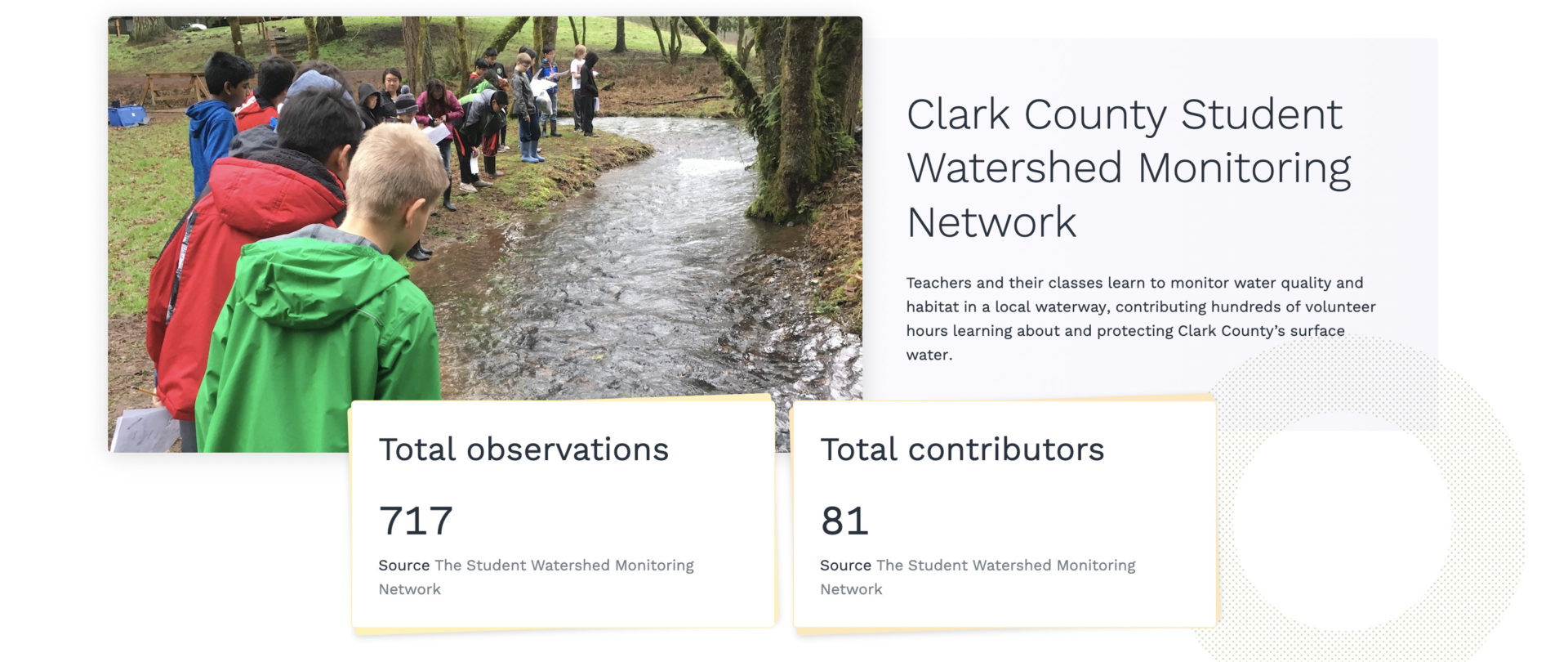
Clark County Student Watershed Monitoring Network
Classrooms in the Pacific Northwest are learning to monitor water quality and habitat in local waterways and engaging in service-learning around protecting surface water through the Clark County Student Watershed Monitoring Network.
Expanding FieldScope’s Reach
Azavea will continue to work on FieldScope’s software development. Our goals include expanding data capacity, supporting offline data entry, and making the application more collaborative with the hope of making FieldScope the ideal host for an even wider variety of projects. We look forward to continuing to support a tool that has proven to be valuable to citizen scientists and science education.