


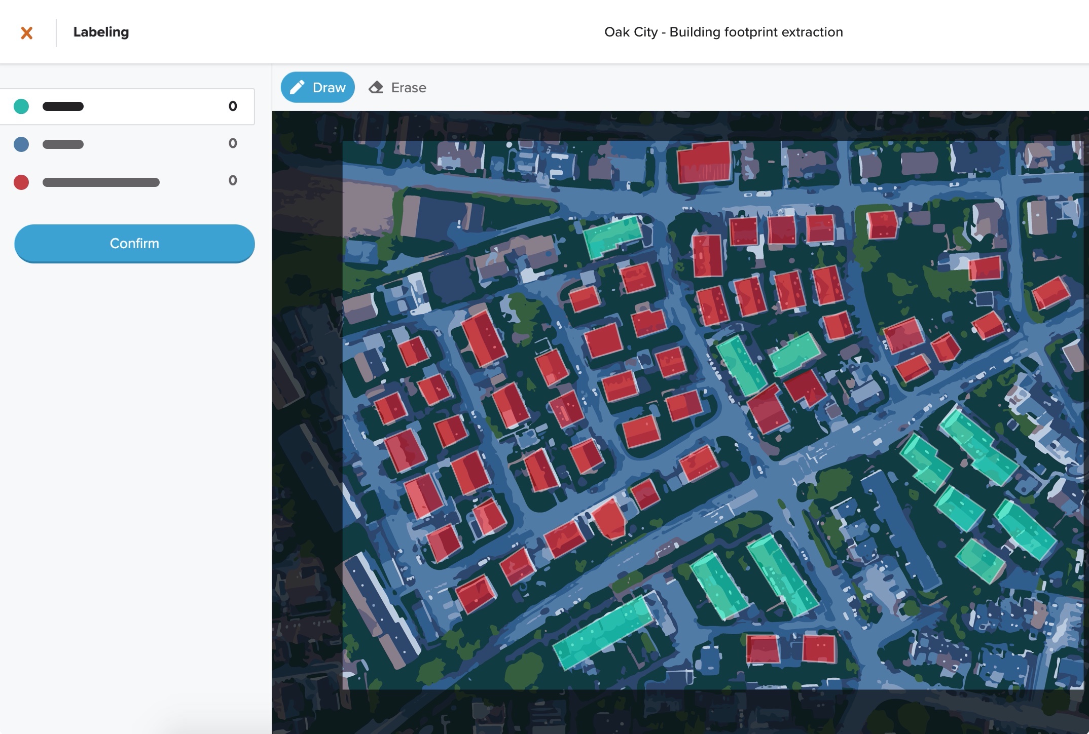
The first annotation tool designed for geospatial data. GroundWork makes labeling satellite, aerial, and drone imagery easy.

Cicero is a comprehensive database of elected officials and legislative districts enabling you to match constituents with their representatives.
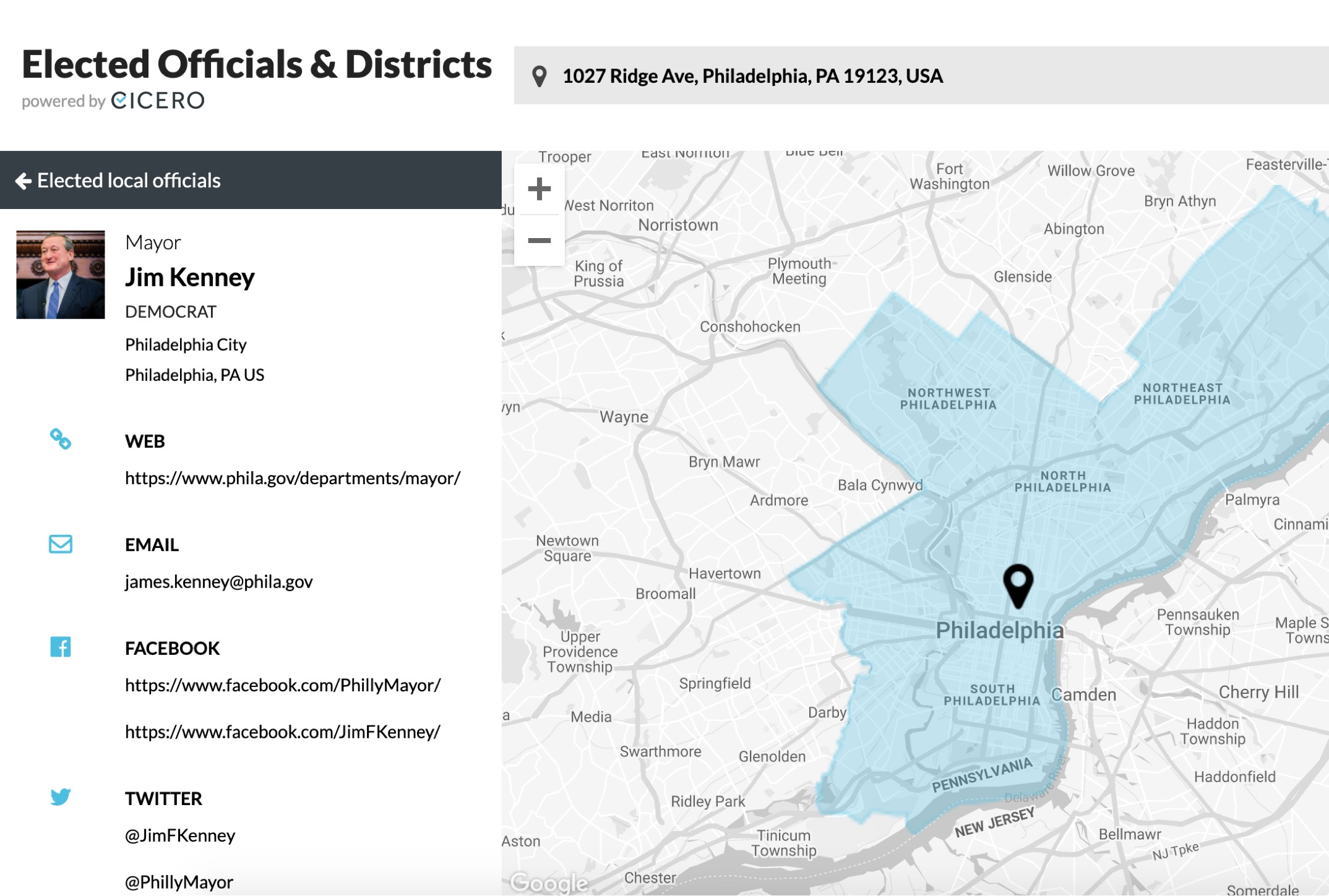
“At Phone2Action, we rely on Cicero’s comprehensive database of elected official and district data to deliver top-tier advocacy products to millions of users around the world. Having been a partner with Cicero for several years now, we have been consistently impressed with the quality of their data and timeliness of their support.”

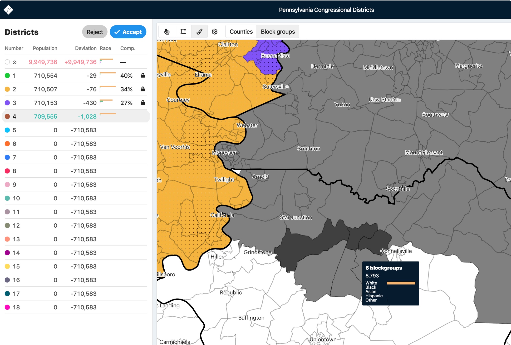
DistrictBuilder enables collaborative redistricting efforts, with the ability to calculate metrics on-the-fly and evaluate comparison to legal requirements.
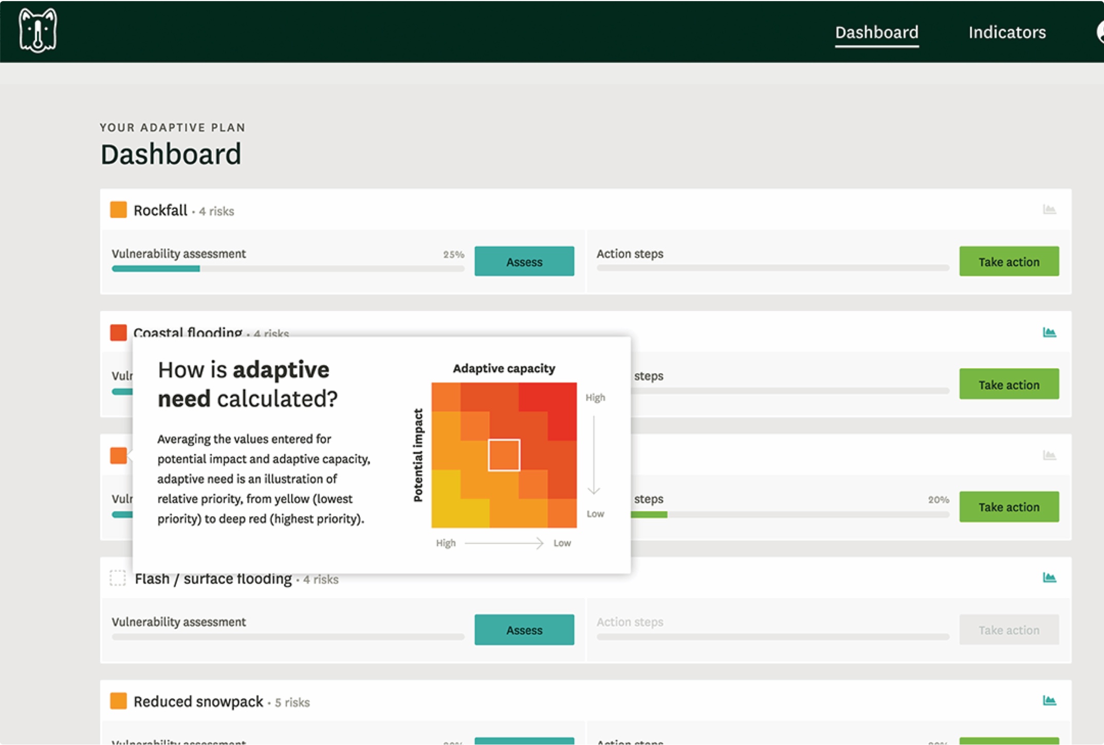
Temperate is a comprehensive, guided app for city-based climate change adaptation planners. Your climate adaptation planning companion.
We have developed many self-hosted, open source products which serve as the backbone to many of our projects. All of these products are openly available and adaptable free of charge.

A geographic data processing engine for high performance applications.

Deep learning for aerial and satellite imagery.

Your source for open data in the Philadelphia region.

A job runner for geospatial machine learning

A STAC and OGC API Features compliant Server

Find, combine and analyze earth imagery at any scale on the web.