 By using computers to automate image analysis, we can help you derive insight from massive data sets that would be difficult for humans to decipher in a lifetime.
From spotting damaged structures post-natural disaster to classifying land use change to identifying tree species based on a picture of the leaf, our work in machine learning and computer vision can help you create iterative processes that enable decision-making, fuel advanced studies, and drive positive change.
Consultation
We’ll help you define both the problem and potential solutions. Our experienced team will recommend the process that fits your need, whether it be semantic segmentation, classification, regression, or object detection.
Labeling data
We’ll define a labeling process and engineer or compile the tools you need to get the job done. Our partners can help annotate data to validate and create training data sets.
Data preparation
Our team will write custom scripts or leverage our Raster Foundry API to create a data set in a friendly format that works with other tools.
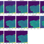
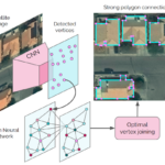
Training and evaluating models
We’ll evaluate architectures and parameters to construct a performant model that identifies features, classifies imagery, or detects objects across huge data sets.
Making predictions
By engineering a service to make predictions that fit your specific use-case, we’ll help you make calculated decisions.
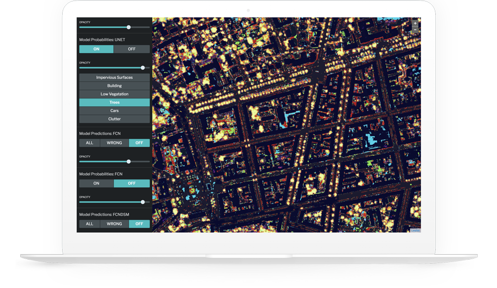
Designing custom apps
We offer software engineering, user experience design, and data analytics services - our well-rounded team can help you construct a custom user interface to fit your process. Check out our open source Raster Foundry app as an example!
Own your data, own the model
We equip your organization to use machine learning to solve problems independently. Our experienced team of engineers and designers can build custom apps on top of open source tech to deliver results faster.
Learn about Raster Vision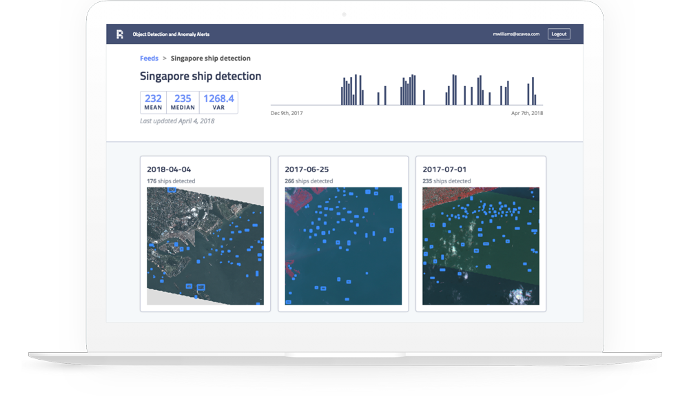
Machine learning in practice
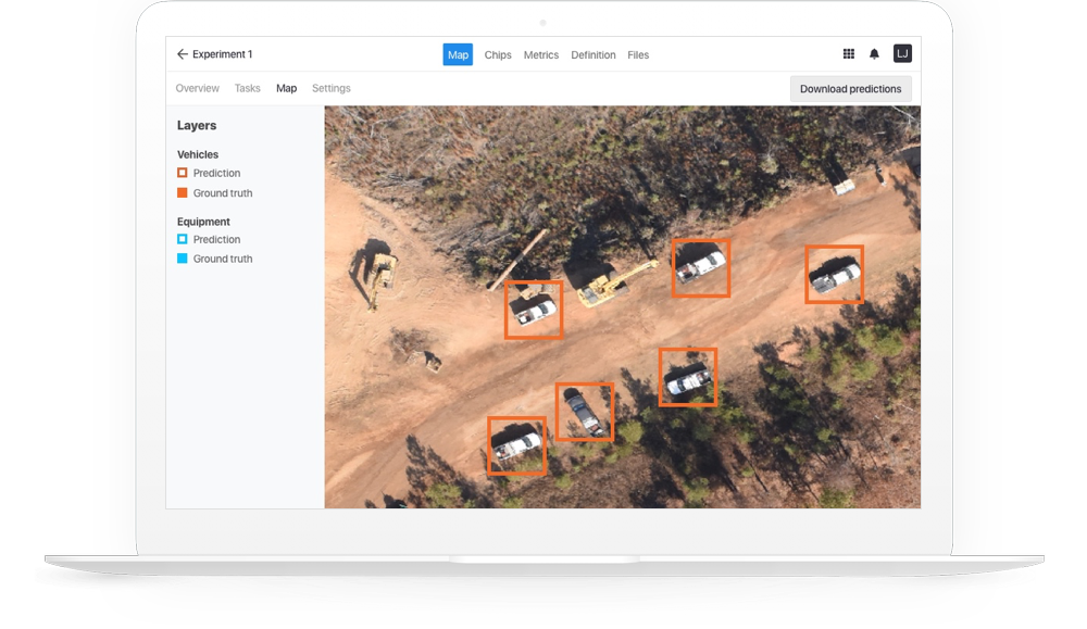
Working with a partner, using long-endurance unmanned aircraft systems, we use machine learning to detect vehicles and construction equipment along hundreds of miles of oil and gas pipeline. The system helps pipeline operators prevent accidents involving third parties digging into the pipeline unknowingly.
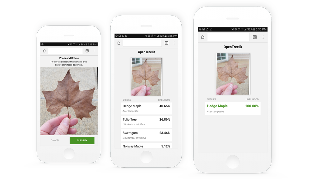
OpenTreeID, a research project with the USDA, is aimed at advancing community forestry with human-augmented computer vision. The mobile site uses a deep learning model trained on a database of images to recognize the species of leaves.
Check out our blog
We write about our methods, projects, and research related to geospatial machine learning.