
Mapping trees out in the field will soon be much more convenient thanks to the launch of the OpenTreeMap mobile app.
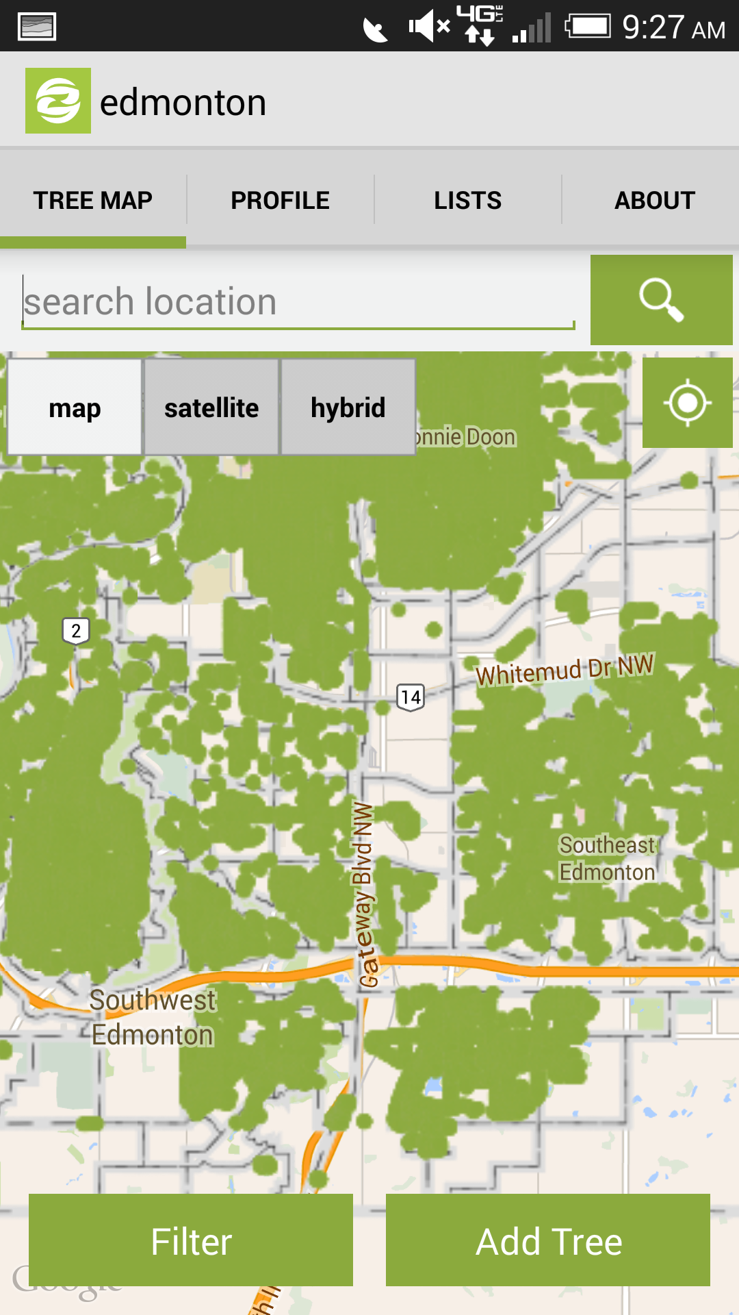
OpenTreeMap encourages users to collaborate with local governments, community organizations, and other groups to map and explore the trees in their communities. Walking around your neighborhood and want to track information about a particular tree? Exploring a local park with your kids and looking for all the trees of a certain species? With the OpenTreeMap mobile app, people can search and add to a database of the trees in their community using the iPhone or Android device already in their pockets. As smartphone use continues to increase, the OpenTreeMap app can provide some fantastic opportunities for encouraging people to explore the urban forest and learn more about the natural environment while spending more time outside and contributing to vital tree surveys.
Previously, PhillyTreeMap, the Grand Rapids Urban Forest Project, and other sites that used the OpenTreeMap code each had individual iPhone and Android apps available through the Apple App Store and Google Play. While this is still an option (check out the new TreeMapLA apps or San Diego County Tree Map apps), we also wanted to build a version of the OpenTreeMap mobile app that supported accessing all publicly visible tree maps from a single smartphone app.
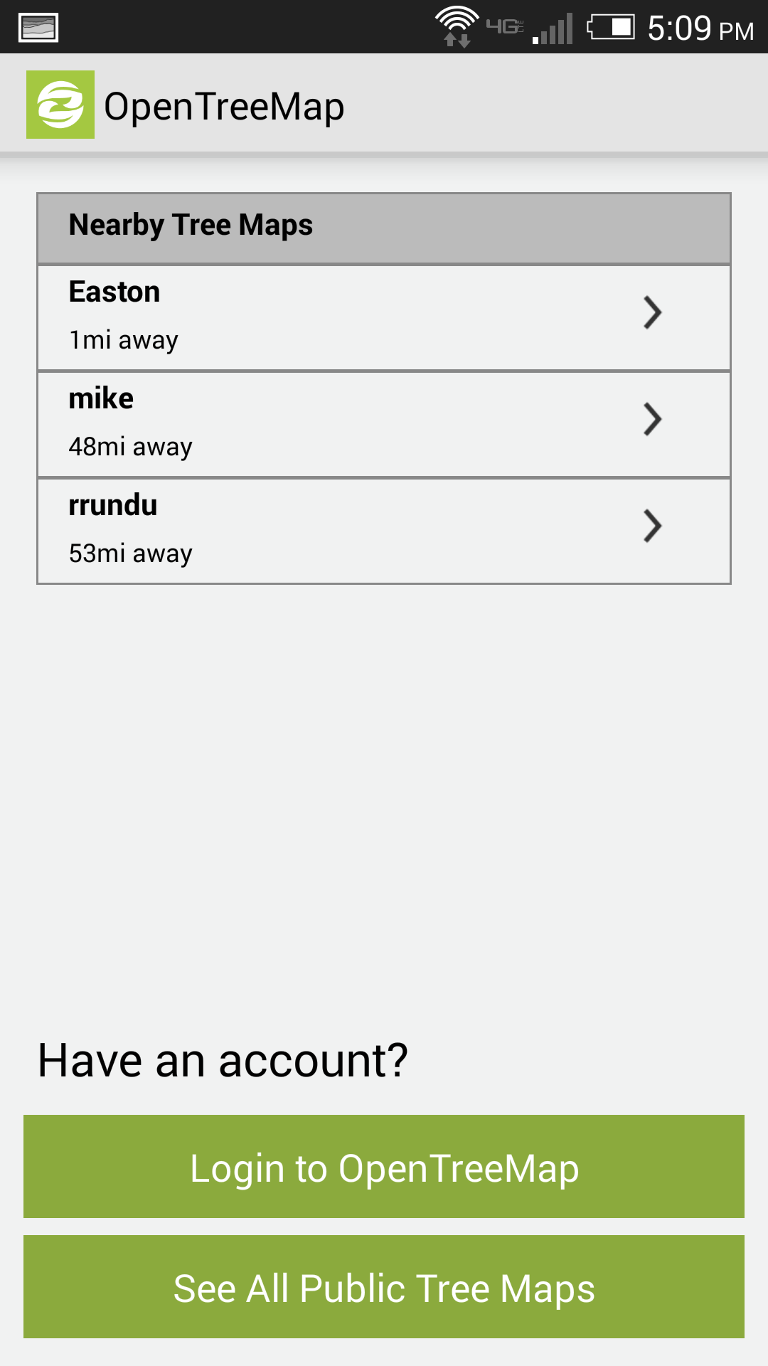
Users can already download the OpenTreeMap mobile app from the Google Play Store and an iOS version will be available in the iTunes App Store in the next few weeks. Using the apps, you can search for tree maps near their location or tree maps you’ve already edited. The mobile app automatically syncs with the main OpenTreeMap database so data added to a particular tree map via the mobile app is also immediately available on the web version of that tree map.
All tree maps created with the OpenTreeMap subscription (except for small maps at the Aspen level) can be accessed through the mobile app. Once an organization or individual creates a tree map, it appears on the list of public tree maps displayed on the main screen of the OpenTreeMap mobile app. Users also can see a list of nearby tree maps in case they are interested in discovering maps close to their location. If a user has edited a map before, that map will appear in a section entitled “My Tree Maps.” By downloading just one mobile app, users will have the ability to edit a variety of OpenTreeMap sites and explore the urban forest in several locations.
Interested in creating an OpenTreeMap site? Visit the OpenTreeMap website to learn more about the software or to sign up for a free trial.