
I was recently introduced to Steve Gifford at Mousebird Consulting, a software firm based in San Francisco that builds mapping tools for the iOS platform. Steve and his colleagues are the developers of the open source iOS mapping framework, WhirlyGlobe Maply. The framework enables them to build both 2D and 3D mapping applications for iPhones and iPads. It’s slick, impressive technology that is sort of a combination of the Google Earth globe and a conventional, web-based mapping application.
Mousebird Consulting joined the LocationTech working group at the Eclipse Foundation in March. LocationTech is a young organization and while there are now several projects moving through the incubation process (GeoTrellis is one of them), there is not yet a lot of coordination or integration between projects. So I was really excited to see Steve take the initiative to integrate one of our GeoTrellis examples, the GeoTrellis Transit API demo, into Mousebird’s WhirlyViz application. GeoTrellis Transit is an extension of the core GeoTrellis framework.
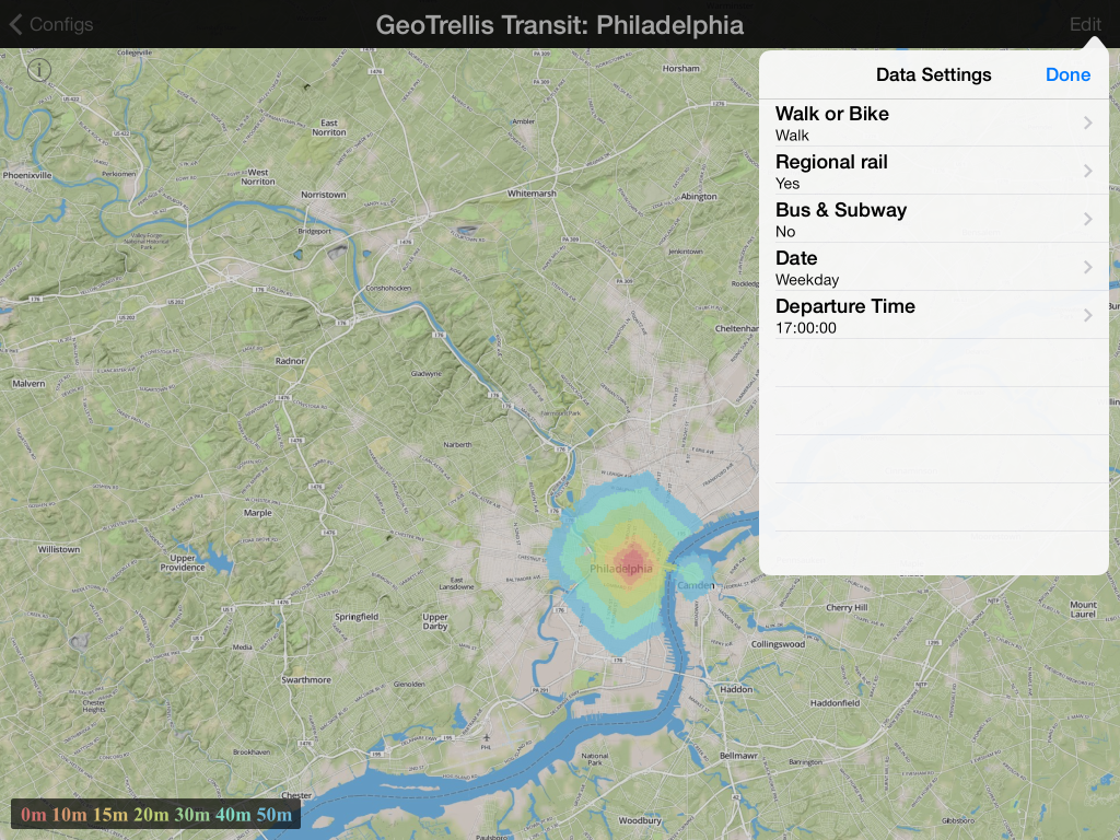
While the core GeoTrellis is primarily focused on fast, distributed raster data processing, the GT Transit project adds support for fast network routing and incorporates both GTFS and OpenStreetMap parsing, a high performance network data structure and support for routing and calculation of time-dependent “travelsheds”, the area a traveler can reach within X minutes. By “time-dependent”, I mean that GT Transit can calculate transit access areas for a specific time of day and days of week using the schedule information encoded in a GTFS data set. All of this is wrapped by an API. When we launched GeoTrellis Transit, we also set up a couple of demos using data for Philadelphia – a travelshed calculator and a “scenic route” demo that shows where you can wander between a starting and ending point and still arrive on time. The WhirlyViz app has some nice design features. It’s a native iOS app, but it uses JSON and Javascript for configuration, and Steve was able to add a new configuration without having to roll out a new application. Steve picked up the Travelshed API and turned it into a new configuration of the WhirlyViz app. It’s pretty cool. In addition to showing the travelsheds, you can set the day-of-week, time-of-day and transit modes. He wrote up some details in a blog post he published last week. Here are a few screenshots.
GeoTrellis Transit uses OpenStreetMap and a GTFS file to enable generation of “travel-sheds”. This one shows walking distance are around downtown.
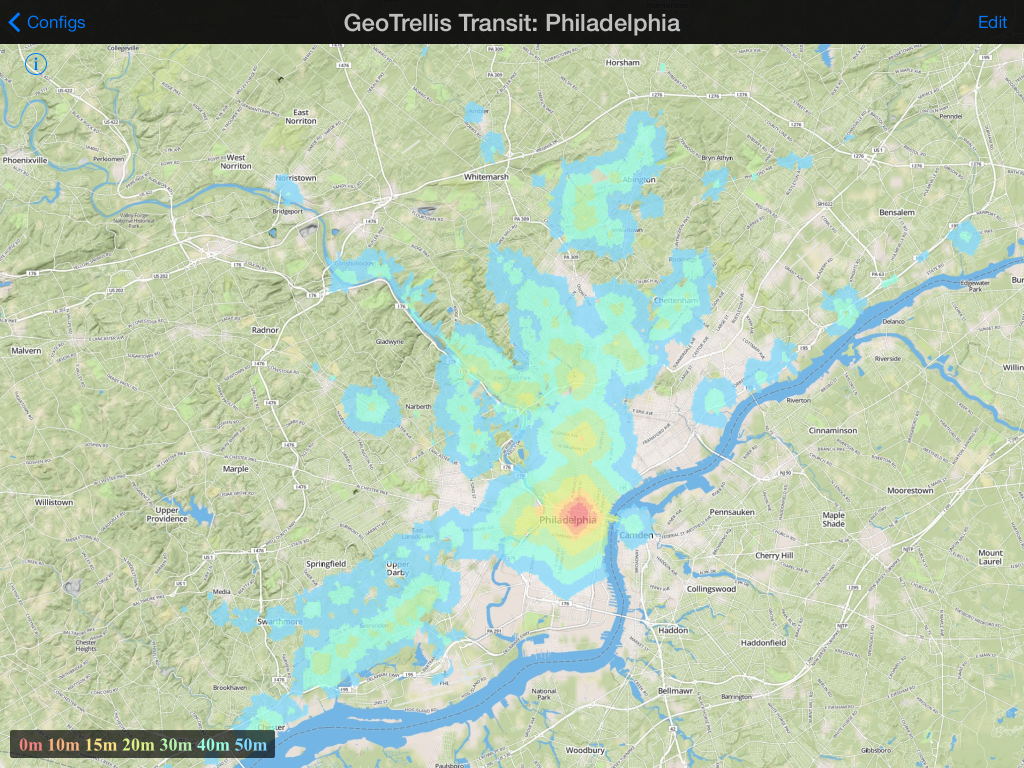
The accessible area changes a great deal when we add access to regional rail.
References
- WhirlyGlobe on GitHub: http://mousebird.github.io/WhirlyGlobe/
- GeoTrellis on GitHub: https://github.com/geotrellis
- GeoTrellis Transit on GitHub: https://github.com/geotrellis/geotrellis-transit
- GeoTrellis Transit API demo: http://transit.geotrellis.com/
- GeoTrellis Transit Travelshed demo: http://transit.geotrellis.com/travelshed.html
- GeoTrellis Transit Scenic Route demo: http://transit.geotrellis.com/scenic.html